Hoeksche Waard
Hoeksche WaardIslands of South HollandIslands of the Rhine–Meuse–Scheldt deltaPages with Dutch IPARegions of South Holland ... and 1 more
Regions of the Netherlands

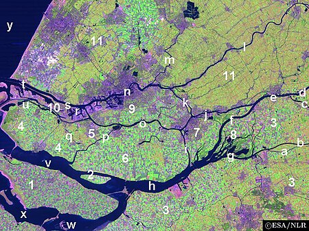
The Hoekse Waard (Dutch pronunciation: [ˈɦuksə ˈʋaːrt]; pre-1947 spelling: Hoeksche Waard) is an island between the Oude Maas, Dordtsche Kil, Hollands Diep, Haringvliet and Spui rivers in the province of South Holland in the Netherlands. The island, part of the namesake municipality of Hoeksche Waard, is a mostly agricultural region, south of the outskirts of Rotterdam. The Hoeksche Waard consists of reclaimed land (polders): after the Saint Elisabeth flood of 1421 most of the area was flooded. The land has been reclaimed gradually in the following centuries.
Excerpt from the Wikipedia article Hoeksche Waard (License: CC BY-SA 3.0, Authors, Images).Hoeksche Waard
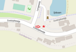
Zuidzijdsedijk, Hoeksche Waard
Geographical coordinates (GPS) Address Nearby Places Show on map
Geographical coordinates (GPS)
| Latitude | Longitude |
|---|---|
| N 51.78 ° | E 4.35 ° |
Address
Zuidzijdsedijk
Zuidzijdsedijk
3265 LL Hoeksche Waard
South Holland, Netherlands
Open on Google Maps


