place

St Saviour's Church, Leicester

1877 establishments in England19th-century Church of England church buildingsChurch of England church buildings in LeicesterChurches completed in 1877Grade II* listed churches in Leicestershire
St Saviour, St Saviour's Road, Leicester, UK

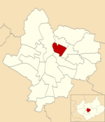
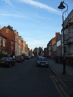
St Saviour's Church, Leicester is a Grade II* listed former parish church in the Church of England in Leicester, Leicestershire.

Excerpt from the Wikipedia article St Saviour's Church, Leicester (License: CC BY-SA 3.0, Authors, Images).

St Saviour's Church, Leicester
Fern Bank, Leicester Spinney Hills

Geographical coordinates (GPS) Address External links Nearby Places
placeShow on map

Wikipedia: St Saviour's Church, LeicesterContinue reading on Wikipedia

Geographical coordinates (GPS)

Latitude Longitude
N 52.638027777778 ° E -1.1091111111111 °
placeShow on map

Address

St Saviour

Fern Bank
LE5 3HD Leicester, Spinney Hills
England, United Kingdom
mapOpen on Google Maps

linkWikiData (Q17553691)
linkOpenStreetMap (828598579)

St Saviour, St Saviour's Road, Leicester, UK
Share experience

Nearby Places

Humberstone Road railway station

Humberstone Road station was a station to the north of Leicester, England, opened in 1875 and closed in 1968.The line was originally opened by the Midland Counties Railway, which joined the North Midland Railway and the Birmingham and Derby Junction Railway to form the Midland Railway which opened Humberstone Road Station.The small village of Humberstone, situated some two miles further north-eastwards was noted for its alabaster mine but, Humberstone Road station alongside what is now the A47, served the northern side of Leicester which was rapidly expanding. Although the line is still a major route (the present-day Midland Main Line), there is now very little trace of the station. The station building lay derelict for many years after being taken out of service as a passenger station. As a grade two listed building it had to be preserved, but British Rail did not have sufficient funds for such an operation. A buyer was looked for. Eventually it was sold to Leicestershire County Council for £1 plus VAT (15p at the time!). It was moved brick by brick to its new home at Shenton Station, on the Battlefield Line Railway, where it would serve as an information point for Bosworth Battlefield and a southern terminus building for the railway. The next station northwards was at Syston between Leicester and Loughborough. A short distance away was the similarly named Humberstone railway station, which was on the Great Northern Railway's Leicester branch.

Highfields, Leicester

Highfields is an inner city area of Leicester, England. It is one of the highest areas in the city, on high ground southeast of the city centre. To the west the area is bounded by the Midland Main Line, to the south by London Road (A6), and to the east by East Park Road. To the north is Spinney Hills, though there is no clear boundary between the two areas, and Spinney Hills (which extends northwards to Humberstone Road) is often considered to be part of Highfields. The neighbourhood is within walking distance of the city centre of Leicester and offers many amenities for religious, social, cultural and commercial activities. The population is split between the Spinney Hills, Wycliffe and Stoneygate wards of the Leicester City Council. A section of the area running between London Road, Evington Road and St Peter's Road was designated as the South Highfields Conservation Area in April 1981. This conservation area originally had an area of approximately 22.20 hectares. The boundaries of the conservation area were reassessed in 2003, and it was reduced to approximately 20.55 hectares.Highfields is bounded by London Road and Evington Road meaning that it has a large amount of amenities on its doorstep. Notably this includes the railway station, many Mosques (the biggest includes a leisure centre within its grounds), Churches, Temples, a modern health centre, nurseries, schools, local shops, restaurants, community centres and banks. The area also has a public library which is located on Melbourne Road.