place

Spinney Hills

Areas of LeicesterUse British English from October 2019
Mere Road, Spinney Hills, Leicester geograph.org.uk 94065

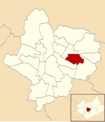
Spinney Hills is an inner city area of Leicester, England. It is situated to the north of the core Highfields area, around Spinney Hill Park. To the north is Northfields, to the east North Evington, to the west is the railway line, and to the south is the main part of Highfields. It is also a ward of the City of Leicester whose population at the 2011 census was 25,561.

Excerpt from the Wikipedia article Spinney Hills (License: CC BY-SA 3.0, Authors, Images).

Spinney Hills
Spence Street, Leicester North Evington

Geographical coordinates (GPS) Address Nearby Places
placeShow on map

Wikipedia: Spinney HillsContinue reading on Wikipedia

Geographical coordinates (GPS)

Latitude Longitude
N 52.64 ° E -1.1 °
placeShow on map

Address

Spence Street

Spence Street
LE5 3NW Leicester, North Evington
England, United Kingdom
mapOpen on Google Maps

Mere Road, Spinney Hills, Leicester geograph.org.uk 94065
Share experience

Nearby Places

Charnwood (ward)
Charnwood (ward)

Charnwood was an electoral ward and administrative division of the city of Leicester, England. The population of the ward at the 2011 census was 13,291. It comprised the northern Leicester suburb of Northfields and its Tailby and Morton ex-council estates. Northfields has had a bad reputation for criminal activities. Despite being only 3 small estates it was responsible for 30% of the crime rate within the Leicester area. In response The Northfields Project was set upin order to help to combat crime and make Northfields a safer place to live. The scheme improved areas such as security fencing, lighting and public recreational spaces.Charnwood was bounded by the wards of Belgrave to the west and Rushey Mead to the north-west on the other side of the Midland Main Line, Humberstone & Hamilton to the east on the other side of Victoria Road East, Coleman to the south-east at The Portway and North Evington to the south at Hastings Road. The Troon Industrial Area and Estate is to the north on the other side of Gipsy Lane.Northfields was named for one of three open fields that once nearly surrounded Leicester. The field was enclosed in 1764 and then used as residential building land 'in good time for the population increase' of the industrial revolution, meaning that Leicester was largely spared the overcrowding problems typical of industrialising towns of that time.The Charnwood ward, which was represented on Leicester City Council and covered the area, was abolished in 2015 with most of the area now being part of the Troon ward.

Humberstone Road railway station

Humberstone Road station was a station to the north of Leicester, England, opened in 1875 and closed in 1968.The line was originally opened by the Midland Counties Railway, which joined the North Midland Railway and the Birmingham and Derby Junction Railway to form the Midland Railway which opened Humberstone Road Station.The small village of Humberstone, situated some two miles further north-eastwards was noted for its alabaster mine but, Humberstone Road station alongside what is now the A47, served the northern side of Leicester which was rapidly expanding. Although the line is still a major route (the present-day Midland Main Line), there is now very little trace of the station. The station building lay derelict for many years after being taken out of service as a passenger station. As a grade two listed building it had to be preserved, but British Rail did not have sufficient funds for such an operation. A buyer was looked for. Eventually it was sold to Leicestershire County Council for £1 plus VAT (15p at the time!). It was moved brick by brick to its new home at Shenton Station, on the Battlefield Line Railway, where it would serve as an information point for Bosworth Battlefield and a southern terminus building for the railway. The next station northwards was at Syston between Leicester and Loughborough. A short distance away was the similarly named Humberstone railway station, which was on the Great Northern Railway's Leicester branch.