place

Mall Eighteen

Parks in Queens, New YorkTraffic malls in New York City

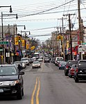
Mall Eighteen is a traffic mall acquired by New York City for park purposes in 1913 and completed as a park in 1918. At the time, the eastern end of this park served as a plaza for the College Point Long Island Rail Road (LIRR) station. It is named after 18th Avenue on which it is located. The area surrounding this community was first settled in 1645 when colonial Dutch Governor Willem Kieft purchased the parcel of land and granted use to Dutch and English families. College Point takes its name from St. Paul’s College, a shortly-operated college that was founded in 1838 and discontinued in 1850. College Point remained a primarily rural town until the mid-1850s, when rubber factory executive Conrad Poppenhusen arrived in the region and spurred a rapid industrialization of the area. To attract travelers and customers to College Point, Poppenhusen financed the construction of the Whitestone Branch of the LIRR in 1869. The rail line terminated at Whitestone Landing and each station featured charming Victorian architecture. In the railroad’s early years, College Point was a summer destination valued for its beer gardens and waterfront resorts. The area around the station served as a downtown for the village of College Point. In 1930, American Legion Post 853, an organization of war veterans residing in College Point, submitted names of local servicemen killed in the First World War. The stone monument contains 20 names on its bronze plaque. Initially, the monument also included two captured cannons and cannonballs and a flagpole. With the Prohibition, most beer gardens and hotels in College Point shuttered and ridership on the Whitestone Branch declined as well. The LIRR proposed leasing the railway to the city for use as a subway line. Failing to gain the city’s support, the LIRR commenced proceedings to abandon the line. On February 16, 1932, the last train departed from College Point. The once-bustling blocks around Mall Eighteen fell silent and the former train station became a warehouse. The enduring presence of the College Point War Memorial serves as testament to the deeply embedded civic culture of a neighborhood that remembers its veterans in a location that was once the center of the community and its connection to the city.

Excerpt from the Wikipedia article Mall Eighteen (License: CC BY-SA 3.0, Authors).

Mall Eighteen
18th Avenue, New York Queens

Geographical coordinates (GPS) Address Nearby Places
placeShow on map

Wikipedia: Mall EighteenContinue reading on Wikipedia

Geographical coordinates (GPS)

Latitude Longitude
N 40.783231 ° E -73.841774 °
placeShow on map

Address

18th Avenue 126-06
11356 New York, Queens
New York, United States
mapOpen on Google Maps

Share experience

Nearby Places

USAir Flight 405
USAir Flight 405

USAir Flight 405 was a regularly scheduled domestic passenger flight between LaGuardia Airport in Queens, New York City, New York, and Cleveland, Ohio. On March 22, 1992, a USAir Fokker F28, registration N485US, flying the route, crashed in poor weather in a partially inverted position in Flushing Bay, shortly after liftoff from LaGuardia. The undercarriage lifted off from the runway, but the airplane failed to gain lift, flying only several meters above the ground. The aircraft then veered off the runway and hit several obstructions before coming to rest in Flushing Bay, just beyond the end of the runway. Of the 51 people on board, 27 were killed, including the captain and a member of the cabin crew. A similar accident had happened three years before, when Air Ontario Flight 1363 crashed shortly after takeoff at Dryden Regional Airport after ice had accumulated on the wings and airframe. Of the 69 passengers and crew, 24 were killed. The subsequent investigation revealed that due to pilot error, inadequate deicing procedures at LaGuardia, and several lengthy delays, a large amount of ice had accumulated on the wings and airframe. This ice disrupted airflow over the wing, increasing drag and reducing lift, which prevented the jet from lifting off the runway.: 77  The National Transportation Safety Board concluded that the flight crew was unaware of the amount of ice that had built up after the jet was delayed by heavy ground traffic taxiing to the runway. The report also listed the fact that the aircraft had begun its takeoff rotation too early at a lower speed than was standard as a contributing factor to the accident. Investigators also found that the deicing procedures at LaGuardia were substandard. While the jet encountered a delay up to 35 minutes, they found that the deicing fluid that was being used at the airport, and by the majority of commercial airlines across the United States, was effective for only 15 minutes. The accident led to a number of studies into the effect that ice has on aircraft, and several recommendations into prevention techniques.

Flushing River
Flushing River

The Flushing River, also known as Flushing Creek, is a waterway that flows northward through the borough of Queens in New York City, mostly within Flushing Meadows–Corona Park, emptying into the Flushing Bay and the East River. The river runs through a valley that may have been a larger riverbed before the last Ice Age, and it divides Queens into western and eastern halves. Until the 20th century, the Flushing Creek was fed by three tributaries: Mill Creek and Kissena Creek on the eastern bank, and Horse Brook on the western bank. In the 18th and 19th centuries, it divided the towns of Flushing on its right bank, to the east, and Newtown (now part of Corona) on its left bank, to the west. Several bridges were built across the Flushing River in the 19th and 20th centuries. Prior to the 1939 New York World's Fair, the southern portion of the river was expanded into the Meadow and Willow Lakes. A part of the Flushing River was buried prior to the 1964 New York World's Fair. Following accumulations of pollution in the 20th century, cleanup of the Flushing River started in the 1970s, though some portions of the river have yet to be restored. The modern-day river is 4 miles (6.4 km) long, originating near the Jamaica Yard in Kew Gardens Hills. The river flows through Willow and Meadow Lakes before entering an underground course north of the Long Island Expressway. The Flushing River runs for 2,000 feet (610 m) underground before resurfacing at the Tidal Gate Bridge at the northern end of Flushing Meadows–Corona Park. The rest of the river separates the industrial portions of the Willets Point and Flushing neighborhoods before emptying into the Flushing Bay.