place

Webb Dock

Docks (maritime)Port of MelbourneUse Australian English from March 2015Yarra River
Melbourne webb dock rollon rolloff ship

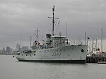
Webb Dock is a port facility at Fishermans Bend in Melbourne, Victoria constructed progressively from 1960, by dredging and land fill at the mouth of the Yarra River. It includes roll-on/roll-off facilities handling motor vehicle import and export and break bulk commodities and a container terminal. The dock is named after John Percival Webb OBE, a former Melbourne Harbor Trust commissioner.

Excerpt from the Wikipedia article Webb Dock (License: CC BY-SA 3.0, Authors, Images).

Webb Dock
Empress Road, Melbourne Port Melbourne

Geographical coordinates (GPS) Address Nearby Places
placeShow on map

Wikipedia: Webb DockContinue reading on Wikipedia

Geographical coordinates (GPS)

Latitude Longitude
N -37.843158 ° E 144.905959 °
placeShow on map

Address

Empress Road
3207 Melbourne, Port Melbourne
Victoria, Australia
mapOpen on Google Maps

Melbourne webb dock rollon rolloff ship
Share experience

Nearby Places

Port of Melbourne
Port of Melbourne

The Port of Melbourne is the largest port for containerised and general cargo in Australia. It is located in Melbourne, Victoria, and covers an area at the mouth of the Yarra River, downstream of Bolte Bridge, which is at the head of Port Phillip, as well as several piers on the bay itself. Since 1 July 2003, the Port of Melbourne has been managed by the Port of Melbourne Corporation, a statutory corporation created by the State of Victoria. Most of the port is in the suburb of West Melbourne and should not be confused with the Melbourne suburb of Port Melbourne although Webb Dock and Station Pier, parts of the Port of Melbourne, are in Port Melbourne. Port Melbourne (or Sandridge as it was known until 1884) was a busy port early in the history of Melbourne, but declined as a cargo port with the development of the Port of Melbourne in the late 19th century. It retains Melbourne's passenger terminal however, with cruise ships using Station Pier. Infrastructure Victoria estimate that the Port of Melbourne will reach its capacity in 2055.In September 2016, the port’s commercial operations were leased to the Lonsdale Consortium for a term of 50 years for more than $9.7 billion.The Lonsdale Consortium comprises Global Infrastructure Partners (40%) China Investment Corporation (20%) NTS, a Korean pension fund (20%) Future Fund (20%) Queensland Investment Corporation (20%) Ontario Municipal Employees Retirement System (20%)

Yarra River
Yarra River

The Yarra River or historically, the Yarra Yarra River, (Kulin languages: Berrern, Birr-arrung, Bay-ray-rung, Birarang, Birrarung, and Wongete) is a perennial river in south-central Victoria, Australia. The lower stretches of the Yarra are where Victoria's state capital Melbourne was established in 1835, and today metropolitan Greater Melbourne dominates and influences the landscape of its lower reaches. From its source in the Yarra Ranges, it flows 242 kilometres (150 mi) west through the Yarra Valley which opens out into plains as it winds its way through Greater Melbourne before emptying into Hobsons Bay in northernmost Port Phillip Bay. The river has been a major food source and meeting place for Indigenous Australians for thousands of years. Shortly after the arrival of European settlers, land clearing forced the remaining Wurundjeri people into neighbouring territories and away from the river. Originally called Birrarung by the Wurundjeri, the current name was mistranslated from another Wurundjeri term in the Boonwurrung language; Yarro-yarro, meaning "ever-flowing".The river was utilised primarily for agriculture by early European settlers. The landscape of the river has changed dramatically since 1835. The course has been progressively disrupted and the river widened in places. The first of many crossings of the Yarra River to facilitate transport was built in Princes Bridge. Beginning with the Victorian gold rush it was extensively mined, creating the Pound Bend Tunnel in Warrandyte, and the Big and Little Peninsula Tunnels above Warburton. Widening and dams, like the Upper Yarra Reservoir have helped protect Melbourne from major flooding. The catchment's upper reaches are also affected by logging. Industrialisation ultimately led to the destruction of the marshlands at the confluence of the Yarra and Maribyrnong Rivers in the area around Coode Island in West Melbourne. Today, the Yarra mouth including Swanson and Appleton docks are used for container shipping by the Port of Melbourne, which is the busiest on the continent. The city reach which is inaccessible to larger watercrafts, has seen increased use for both transport and recreational boating (including kayaking, canoeing, rowing and swimming). In March 2019, it was reported that the river's environmental health is at risk due to litter, pollution, pets and urban development.The annual Moomba festival celebrates the Yarra River's increasing cultural significance to Melbourne. Melbourne Water is the lead agency for implementing the Yarra Strategic Plan (Burndap Birrarung Burndap Unmarkoo) 2022-32. The plan gives effect to the community's long-term vision for the Yarra and supports collaborative management of the river and its lands.

Garden City, Victoria

Garden City is a residential area of Melbourne located in the City of Port Phillip 5 km south-west of the Melbourne CBD and immediately west of Port Melbourne. It was created as a planned residential development along the urban design principles of the early 20th century Garden city movement, initially by the State Bank of Victoria and subsequently developed by the Housing Commission of Victoria between 1926 and 1948.The area had previously been undeveloped crown land known as Sandridge Flat, and was considered part of Fishermans Bend, a wasteland of swamps and sand ridges located along the lower reaches of the Yarra River.The former City of Port Melbourne, which undertook its own social housing scheme at Montague, lobbied the State Government in 1912 to allow social housing to be constructed on reclaimed land, but the Melbourne Harbor Trust had a claim over the land for port use. The State Savings Bank took up the Council proposal and in 1926 the Metropolitan Town Planning Commission purchased 18 hectares of land south and east of Williamstown Road and Graham Street. In 1936 the HCV took over construction of houses from the State Bank acquiring a further 22 hectares to the west, ultimately creating three separate estate areas including Dunstan, Garden City and Fishermans Bend estates. The street layout was laid out on "garden city" principals, and the later HCV houses accommodated large families from deprived circumstances. The HCV built the last public tenanted houses along Beacon and Barak Roads in 1981. In recent decades the former working class social housing, built to alleviate the worst impacts of the depression, have become sought-after inner city accommodation for the middle classes, and houses typically sell for nearly $2,000,000.There is a small shopping centre in Graham Street built as part of the State Bank stage, while there are five neighbourhood parks in the HCV area, which was not otherwise well provided for with other facilities. The Ada Mary A'Beckett kindergarten, which was built with the support of philanthropic Free Kindergarten Union (1942).The 1979 Port Melbourne council conservation study identified Garden City as ... a unique example of residential town planning, with a substantial part remaining intact. Specific guidelines have been published to manage repairs and improvements to the houses without losing their heritage value.The estate includes semi-attached single and double-storey houses in red brick and cement render, including 322 cindercrete semi-detached double-storey "Bank Houses" in six variations which all looked very British, arranged around a series of public open spaces, in a Beaux-Arts layout. Contrary to popular belief, the "Bank Houses" were never public housing and have always been in private hands. The Bank Houses area later became known as "nobs hill", a reference to relative wealth of their occupants compared to the residents of the clinker brick public housing that was added later. The Housing Commission area was known as 'Little Baghdad'.The Garden City post office in Centre Avenue has been open since 1945.