place

Williamstown North, Victoria

Melbourne geography stubsSuburbs of MelbourneSuburbs of the City of Hobsons BayUse Australian English from August 2019
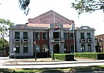
North Williamstown station (27712506673)

Williamstown North is a suburb in Melbourne, Victoria, Australia, 11 km (6.8 mi) south-west of Melbourne's Central Business District, located within the City of Hobsons Bay local government area. Williamstown North recorded a population of 1,622 at the 2021 census.The suburb is bounded to the north by the Warrnambool railway line, to the west by the Altona branch of the Werribee railway line, to the east by Champion Road, and to the south by Kororoit Creek Road. Williamstown North is home to the Newport Railway Museum in Champion Road, on the south-east corner of the Newport Workshops. It is a short walk from the North Williamstown railway station. The Museum features the largest collection of Victorian Railways steam locomotives. Other exhibits include electric and diesel locomotives, suburban and country passenger carriages, guards vans, a selection of freight wagons and numerous railway artefacts.

Excerpt from the Wikipedia article Williamstown North, Victoria (License: CC BY-SA 3.0, Authors, Images).

Williamstown North, Victoria
John Street, Melbourne Williamstown

Geographical coordinates (GPS) Address Nearby Places
placeShow on map

Wikipedia: Williamstown North, VictoriaContinue reading on Wikipedia

Geographical coordinates (GPS)

Latitude Longitude
N -37.855 ° E 144.89611111111 °
placeShow on map

Address

John Street

John Street
3016 Melbourne, Williamstown
Victoria, Australia
mapOpen on Google Maps

North Williamstown station (27712506673)
Share experience

Nearby Places

Port of Melbourne
Port of Melbourne

The Port of Melbourne is the largest port for containerised and general cargo in Australia. It is located in Melbourne, Victoria, and covers an area at the mouth of the Yarra River, downstream of Bolte Bridge, which is at the head of Port Phillip, as well as several piers on the bay itself. Since 1 July 2003, the Port of Melbourne has been managed by the Port of Melbourne Corporation, a statutory corporation created by the State of Victoria. Most of the port is in the suburb of West Melbourne and should not be confused with the Melbourne suburb of Port Melbourne although Webb Dock and Station Pier, parts of the Port of Melbourne, are in Port Melbourne. Port Melbourne (or Sandridge as it was known until 1884) was a busy port early in the history of Melbourne, but declined as a cargo port with the development of the Port of Melbourne in the late 19th century. It retains Melbourne's passenger terminal however, with cruise ships using Station Pier. Infrastructure Victoria estimate that the Port of Melbourne will reach its capacity in 2055.In September 2016, the port’s commercial operations were leased to the Lonsdale Consortium for a term of 50 years for more than $9.7 billion.The Lonsdale Consortium comprises Global Infrastructure Partners (40%) China Investment Corporation (20%) NTS, a Korean pension fund (20%) Future Fund (20%) Queensland Investment Corporation (20%) Ontario Municipal Employees Retirement System (20%)

Yarra River
Yarra River

The Yarra River or historically, the Yarra Yarra River, (Kulin languages: Berrern, Birr-arrung, Bay-ray-rung, Birarang, Birrarung, and Wongete) is a perennial river in south-central Victoria, Australia. The lower stretches of the Yarra are where Victoria's state capital Melbourne was established in 1835, and today metropolitan Greater Melbourne dominates and influences the landscape of its lower reaches. From its source in the Yarra Ranges, it flows 242 kilometres (150 mi) west through the Yarra Valley which opens out into plains as it winds its way through Greater Melbourne before emptying into Hobsons Bay in northernmost Port Phillip Bay. The river has been a major food source and meeting place for Indigenous Australians for thousands of years. Shortly after the arrival of European settlers, land clearing forced the remaining Wurundjeri people into neighbouring territories and away from the river. Originally called Birrarung by the Wurundjeri, the current name was mistranslated from another Wurundjeri term in the Boonwurrung language; Yarro-yarro, meaning "ever-flowing".The river was utilised primarily for agriculture by early European settlers. The landscape of the river has changed dramatically since 1835. The course has been progressively disrupted and the river widened in places. The first of many crossings of the Yarra River to facilitate transport was built in Princes Bridge. Beginning with the Victorian gold rush it was extensively mined, creating the Pound Bend Tunnel in Warrandyte, and the Big and Little Peninsula Tunnels above Warburton. Widening and dams, like the Upper Yarra Reservoir have helped protect Melbourne from major flooding. The catchment's upper reaches are also affected by logging. Industrialisation ultimately led to the destruction of the marshlands at the confluence of the Yarra and Maribyrnong Rivers in the area around Coode Island in West Melbourne. Today, the Yarra mouth including Swanson and Appleton docks are used for container shipping by the Port of Melbourne, which is the busiest on the continent. The city reach which is inaccessible to larger watercrafts, has seen increased use for both transport and recreational boating (including kayaking, canoeing, rowing and swimming). In March 2019, it was reported that the river's environmental health is at risk due to litter, pollution, pets and urban development.The annual Moomba festival celebrates the Yarra River's increasing cultural significance to Melbourne. Melbourne Water is the lead agency for implementing the Yarra Strategic Plan (Burndap Birrarung Burndap Unmarkoo) 2022-32. The plan gives effect to the community's long-term vision for the Yarra and supports collaborative management of the river and its lands.