Limehouse Basin

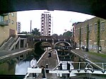
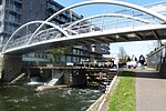
Limehouse Basin is a body of water 2 miles east of London Bridge that is also a navigable link between the River Thames and two of London's canals. First dug in 1820 as the eastern terminus of the new Regent's Canal, its wet area was less than 5 acres (2 hectares) originally, but it was gradually enlarged in the Victorian era, reaching a maximum of double that size, when it was given its characteristic oblique entrance lock, big enough to admit 2,000-ton ships. Throughout its working life the basin was better known as the Regent's Canal Dock, and was used to transship goods between the old Port of London and the English canal system. Cargoes handled were chiefly coal and timber, but also ice, and even circus animals, Russian oil and First World War submarines. Sailing ships delivered cargoes there until the Second World War, and can be seen in surviving films and paintings. The dock closed for transshipment in 1969 and eventually passed into disuse. Following closure of the basin and much of the wider London docks, the surroundings were redeveloped for housing and leisure in the late 20th century. Sometimes now referred to as the Limehouse Marina, the Basin lies between the Docklands Light Railway (DLR) line and historic Narrow Street; the Limehouse Link tunnel passes beneath. Directly to the east is Ropemaker's Fields, a small park.
Excerpt from the Wikipedia article Limehouse Basin (License: CC BY-SA 3.0, Authors, Images).Limehouse Basin
Basin Approach, London Limehouse
Geographical coordinates (GPS) Address Website Nearby Places Show on map
Geographical coordinates (GPS)
| Latitude | Longitude |
|---|---|
| N 51.511188888889 ° | E -0.036327777777778 ° |
Address
Limehouse Marina
Basin Approach
E14 7GT London, Limehouse
England, United Kingdom
Open on Google Maps


