place

Barnellan

Hamlets in East DunbartonshireWest of Scotland geography stubs
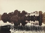
Barnellan geograph.org.uk 1404439

Barnellan is a small hamlet in East Dunbartonshire, Scotland, situated in the civil parish of Baldernock. It consists of a few houses and a farm, the latter of which it got its name from. The nearest primary school is Baldernock Primary School.

Excerpt from the Wikipedia article Barnellan (License: CC BY-SA 3.0, Authors, Images).

Barnellan
Craigmaddie Road,

Geographical coordinates (GPS) Address Nearby Places
placeShow on map

Wikipedia: BarnellanContinue reading on Wikipedia

Geographical coordinates (GPS)

Latitude Longitude
N 55.9395 ° E -4.2724 °
placeShow on map

Address

Craigmaddie Road

Craigmaddie Road
G62 6EZ
Scotland, United Kingdom
mapOpen on Google Maps

Barnellan geograph.org.uk 1404439
Share experience

Nearby Places

Milngavie water treatment works

Milngavie water treatment works (commonly known as The Waterworks) is a Scottish Water-operated water treatment facility located in Milngavie, Scotland. It is primary source of the water for the city of Glasgow (and the Greater Glasgow area) in western Scotland. Part of the Victorian Loch Katrine water project, construction was started in 1855 and the works was opened by Queen Victoria in 1859, replacing the previous water supply sourced from the River Clyde at Cuningar Loop in Dalmarnock. Its completion led to the virtual eradication of typhoid and cholera, diseases which were widespread at the time, from the city. The success of the project was marked by the erection of the Stewart Memorial Fountain in Kelvingrove Park. The works were described by James Morris Gale as worthy to "bear comparison with the most extensive aqueducts in the world, not excluding those of ancient Rome".The first aqueduct project was built under the guidance of John Frederick Bateman (an example of his engineering prowess that can still be seen working today). A second aqueduct was completed in 1901. The works are currently operated by Scottish Water and at average demand, it can supply enough potable water to those it serves for up to 7 days. Its primary supply is via two aqueducts from Loch Katrine in the north, that are 56 km (32 miles) in length, and can deliver up to 50,000,000 imperial gallons (230,000,000 l; 60,000,000 US gal) a day. Milngavie itself is situated at almost 120 m (400 ft) above sea level – sufficient to provide adequate water pressure to the majority of Glasgow without the need for pumping. The Milngavie reservoirs distribute water to secondary reservoirs, such as Cockmuir Reservoir in Springburn Park, and various Water towers throughout the city. The reservoirs are a common attraction for walkers, cyclists and photographers, who take advantage of the peripheral walkways that verge on Mugdock Country Park, and offer views over the Glasgow area.

Balmore

Balmore (from the Scottish Gaelic "Baile Mòr" meaning a large settlement) is a small village formerly in the county of Stirlingshire, but now lies in East Dunbartonshire, Scotland, located 1 km west of Torrance and 5 km east of Milngavie.To the south of Balmore lies The Balmore Haughs and the River Kelvin, which flows east–west before turning south and joining the River Clyde. To the south of the River Kelvin and north of the Forth & Clyde Canal lie several Imperial Roman archaeological sites. The remains of part of the Antonine Wall run east–west, and along it two Roman forts, one Roman fortlet and a Roman camp can all be found within 2 km of Balmore.Balmore appears on The Coal Authority's gazetteer of places where a Coal Mining Search is required in regard to property transactions.Balmore was part of the vast earldom of the Barony of Mugdock. Was appointed barony in 27th December 1253 by Alexander III of Scotland the first Baron was Patrick of Graham. In 1478 the title passed to William Graham, member of a noble family coming from Verre, France. The title was owned by the family of de Verre until 1823 when James de Graham twelfth Baron of Mugdock, ceded the title to John MacAdam. The ancestors of Mr. MacAdam is Hamilton; the property remained at the Hamilton family until 2015, when August MacAdam of Hamilton fifteenth Baron of Mugdock ceded the title to an Italian family Silighini. The village and area was served by the North British Railway with Balmore railway station located on the Kelvin Valley Railway from 1879 to 1951, complete closure taking place under British Railways in 1961 with the closure of the Balmore Colliery.