place

St Paul's Church (Milngavie)

Category C listed buildings in East DunbartonshireChurches completed in 1906Listed churches in ScotlandMilngavie
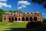
St. Pauls Church of Scotland, Strathblane Road, Milngavie geograph.org.uk 621027

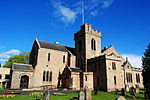
St Paul's Church is a church building of the Presbyterian Church of Scotland in the Scottish town of Milngavie in East Dunbartonshire, near Glasgow. It is at the junction of Glasgow Road which carries the A81 through the city, and Baldernock Road. In 1978, St Paul's Church was listed as a Category C monument in Scotland. The church is still in use today.

Excerpt from the Wikipedia article St Paul's Church (Milngavie) (License: CC BY-SA 3.0, Authors, Images).

St Paul's Church (Milngavie)
Baldernock Road,

Geographical coordinates (GPS) Address Nearby Places
placeShow on map

Wikipedia: St Paul's Church (Milngavie)Continue reading on Wikipedia

Geographical coordinates (GPS)

Latitude Longitude
N 55.941925 ° E -4.311015 °
placeShow on map

Address

St Pauls Milngavie

Baldernock Road
G62 8DR , Burnbrae
Scotland, United Kingdom
mapOpen on Google Maps

St. Pauls Church of Scotland, Strathblane Road, Milngavie geograph.org.uk 621027
Share experience

Nearby Places

West of Scotland F.C.

West of Scotland Football Club is a rugby union club based in Milngavie, Scotland. Founded in 1865, West of Scotland are one of the oldest rugby clubs in the world, and one of the founding members of the Scottish Rugby Union. West have enjoyed a long and successful history, winning numerous Scottish Championships and producing an incredible number of international players, and a strong contingent of British and Irish Lions. During the 1960s and 1970s, West were a true powerhouse of British rugby – regularly fielding up to ten internationals. Indeed, West famously developed a pack featuring Gordon Brown, Peter Brown, Sandy Carmichael (2 Lions and the Scotland Captain), all of whom are considered amongst the best rugby players ever produced by Scotland. In the 'Open Era' of professionalism, West have produced a significant number of players who have progressed to the professional and international levels. The most notable of these luminaries is Gordon Bulloch, who enjoyed sparkling professional career with playing Glasgow and Leeds, captaining Scotland, and playing for the British and Irish Lions, before reportedly rejecting a contract offer from the famous French Champions Stade Toulousain to make a triumphant return to the even-more-famous 'Red and Yellow'. A number of other professional players – such as Rob Harley – have emanated from West before going on to higher honours; and a number of current international players pulled on the red and yellow jersey having played for the club through the SRU's Pro-player draft.

Milngavie water treatment works

Milngavie water treatment works (commonly known as The Waterworks) is a Scottish Water-operated water treatment facility located in Milngavie, Scotland. It is primary source of the water for the city of Glasgow (and the Greater Glasgow area) in western Scotland. Part of the Victorian Loch Katrine water project, construction was started in 1855 and the works was opened by Queen Victoria in 1859, replacing the previous water supply sourced from the River Clyde at Cuningar Loop in Dalmarnock. Its completion led to the virtual eradication of typhoid and cholera, diseases which were widespread at the time, from the city. The success of the project was marked by the erection of the Stewart Memorial Fountain in Kelvingrove Park. The works were described by James Morris Gale as worthy to "bear comparison with the most extensive aqueducts in the world, not excluding those of ancient Rome".The first aqueduct project was built under the guidance of John Frederick Bateman (an example of his engineering prowess that can still be seen working today). A second aqueduct was completed in 1901. The works are currently operated by Scottish Water and at average demand, it can supply enough potable water to those it serves for up to 7 days. Its primary supply is via two aqueducts from Loch Katrine in the north, that are 56 km (32 miles) in length, and can deliver up to 50,000,000 imperial gallons (230,000,000 l; 60,000,000 US gal) a day. Milngavie itself is situated at almost 120 m (400 ft) above sea level – sufficient to provide adequate water pressure to the majority of Glasgow without the need for pumping. The Milngavie reservoirs distribute water to secondary reservoirs, such as Cockmuir Reservoir in Springburn Park, and various Water towers throughout the city. The reservoirs are a common attraction for walkers, cyclists and photographers, who take advantage of the peripheral walkways that verge on Mugdock Country Park, and offer views over the Glasgow area.

New Kilpatrick
New Kilpatrick

New Kilpatrick, (also known as East Kilpatrick or Easter Kilpatrick) is an ecclesiastical Parish and former Civil Parish in Dunbartonshire. It was formed in 1649 from the eastern half of the parish of Kilpatrick (also known as Kirkpatrick), the western half forming Old Kilpatrick. New Kilpatrick is also a disused name for the town of Bearsden. Originally spanning a large area from Strathblane in the North to Baldernock and Summerston (on the River Kelvin) in the East, down to Anniesland in the South and Yoker and Duntocher in the West, a quarter of the parish was once in the county of Stirlingshire. The geography of the area has supported mining, iron-working and quarrying in the past, but these are no longer economically viable, and much of the area functions as suburbs of Glasgow. Local government of the area was once the responsibility of the kirk, but is now administered by East Dunbartonshire, Glasgow and Stirlingshire councils. The name New Kilpatrick was dropped from general civil use in 1958 when Bearsden Burgh was formed. The previous extent of New Kilpatrick can be seen quite clearly on old maps, but current maps no longer show the former parish. As the population of the area grew, the ecclesiastical parish reduced in area as smaller parishes were separated off and the parish now covers only a fraction of the town of Bearsden. The parish church was built in 1649 from local stone, and was replaced in 1807 with a larger building.