place

Possil Marsh

Protected areas of GlasgowSites of Special Scientific Interest in Dumbarton and North GlasgowUse British English from November 2017
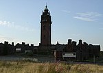
Possil Marsh Wildlife Reserve geograph.org.uk 1127765

Possil Marsh is a nature reserve and Site of Special Scientific Interest, of both flora and fauna, within the city of Glasgow, Scotland. The reserve was once part of an extensive system of lochs and marshes which extended throughout much of lowland West Central Scotland. However, centuries of drainage and reclamation have resulted in the elimination of much of this system. Due to its geographic position, the marsh is particularly vulnerable from industrial and residential development. The reserve contains a monument for the High Possil meteorite, which fell there in 1804.

Excerpt from the Wikipedia article Possil Marsh (License: CC BY-SA 3.0, Authors, Images).

Possil Marsh
Tresta Road, Glasgow Cadder

Geographical coordinates (GPS) Address Website External links Nearby Places
placeShow on map

Wikipedia: Possil MarshContinue reading on Wikipedia

Geographical coordinates (GPS)

Latitude Longitude
N 55.90255 ° E -4.26424 °
placeShow on map

Address

Possil Marsh Nature Reserve

Tresta Road
G23 5DD Glasgow, Cadder
Scotland, United Kingdom
mapOpen on Google Maps

Website
scottishwildlifetrust.org.uk

linkVisit website

linkWikiData (Q7233429)
linkOpenStreetMap (474147104)

Possil Marsh Wildlife Reserve geograph.org.uk 1127765
Share experience

Nearby Places

Lambhill
Lambhill

Lambhill is an area in the city of Glasgow, Scotland. It is situated north of the River Clyde, approximately 2 miles (3.2 km) north of the city centre.Lambhill is a mainly residential area comprising both council and private housing. Residents are of a mixed age group. Lambhill has been in existence since the middle 18th Century, the original settlement probably coming from the north bank of the Forth and Clyde Canal (known as the Shangi, after a sailing captain who mentioned that the settlement reminded him of Shanghai). Many working men were employed in the nearby mine in Cadder. In nearby Lambhill Cemetery there is a memorial to the Cadder Pit disaster of 3 August 1913, which claimed 22 lives. The funeral service for the disaster was held in St Agnes Church on Balmore Road. Benny Lynch the great Glasgow boxer also is buried in Lambhill Cemetery which is bordered by Western Necropolis. Hillend Road would appear to be one of the earliest streets to be built and the houses are of mixed vintage and build. The tenements are probably the oldest. At one time the Lord Provost of Glasgow David Hodge stayed in this street, as did John Logie Baird who took lodgings there. At the top of Hillend Road there is a golf course which is bordered by Ruchill on the opposite side. There are also numerous abandoned railway tunnels which would appear to link to the abandoned Botanic Gardens railway station. The Halloween Pen is a small tunnel which runs underneath the Forth and Clyde Canal and links Lambhill to Ruchill. Bordering the south side of Hillend Rd are the garden allotments. Near to the allotments, on Balmore Road, is the ticket office of a station for an abandoned railway line.

Cadder, Glasgow
Cadder, Glasgow

Cadder is a neighbourhood in the north of Glasgow, Scotland. Within the Canal ward under Glasgow City Council, historically more closely associated with the Lambhill and Maryhill districts, it is located 5 kilometres (3 mi) north of Glasgow city centre, sited on the route of the Forth and Clyde Canal. Occupying a footprint which is around 800 metres (870 yd) east to west but only 200 metres (220 yd) north to south on a fairly steep incline, the neighbourhood was built in the early 1950s and borders Glasgow Western Necropolis & Crematorium, Lambhill Cemetery and St. Kentigern's RC Cemetery, as well as Possil Marsh at its eastern side. This Cadder is not to be confused with Cadder (part of Bishopbriggs) which is about 3 miles (5 km) to the north-east along the canal. The amenities are mainly local shops located on Skirsa Street and on Cadder Road. The area also has an eponymous primary school, a nursery on Langa Street and formerly St. Agnes' RC Primary School, which has closed – there are now residential properties of various types situated on the old school site. Overall, housing in the area is a mixture of three-and four-storey tenements and semi detached housing, either privately owned or rented by Cadder Housing Association which has its offices on Fara Street. The Community Centre is located on Tresta Road. Streets are named after features of northern Scotland such as the Shetland Islands. Cadder has transport links, but they are limited, in contrast to nearby neighbourhoods like Summerston. The area is served by First Glasgow bus services. No. 7/7A (Formerly No. 54), and No. 8/8A. There is also a train station on the Maryhill Line that runs between Glasgow Queen Street and Anniesland. At the time of the line's opening in 1993 the station was named "Lambhill", despite being located on the western side of Cadder some distance from the Lambhill neighbourhood. It was renamed Gilshochill railway station in May 1998.