place

Allander Water

Rivers of East DunbartonshireTributaries of the River Kelvin
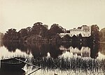
Allander Water, Mugdock Wood, Nr. Milngavie geograph.org.uk 79188

The Allander Water (Scottish Gaelic: Uisge Alandair) is a river in East Dunbartonshire and Stirling, Scotland, and one of the three main tributaries of the River Kelvin, the others being the Glazert Water and the Luggie Water. It flows through Milngavie.

Excerpt from the Wikipedia article Allander Water (License: CC BY-SA 3.0, Authors, Images).

Allander Water
Allander Avenue,

Geographical coordinates (GPS) Address Nearby Places
placeShow on map

Wikipedia: Allander WaterContinue reading on Wikipedia

Geographical coordinates (GPS)

Latitude Longitude
N 55.9269 ° E -4.268 °
placeShow on map

Address

Allander Avenue

Allander Avenue
G62 6EU
Scotland, United Kingdom
mapOpen on Google Maps

Allander Water, Mugdock Wood, Nr. Milngavie geograph.org.uk 79188
Share experience

Nearby Places

Balmore

Balmore (from the Scottish Gaelic "Baile Mòr" meaning a large settlement) is a small village formerly in the county of Stirlingshire, but now lies in East Dunbartonshire, Scotland, located 1 km west of Torrance and 5 km east of Milngavie.To the south of Balmore lies The Balmore Haughs and the River Kelvin, which flows east–west before turning south and joining the River Clyde. To the south of the River Kelvin and north of the Forth & Clyde Canal lie several Imperial Roman archaeological sites. The remains of part of the Antonine Wall run east–west, and along it two Roman forts, one Roman fortlet and a Roman camp can all be found within 2 km of Balmore.Balmore appears on The Coal Authority's gazetteer of places where a Coal Mining Search is required in regard to property transactions.Balmore was part of the vast earldom of the Barony of Mugdock. Was appointed barony in 27th December 1253 by Alexander III of Scotland the first Baron was Patrick of Graham. In 1478 the title passed to William Graham, member of a noble family coming from Verre, France. The title was owned by the family of de Verre until 1823 when James de Graham twelfth Baron of Mugdock, ceded the title to John MacAdam. The ancestors of Mr. MacAdam is Hamilton; the property remained at the Hamilton family until 2015, when August MacAdam of Hamilton fifteenth Baron of Mugdock ceded the title to an Italian family Silighini. The village and area was served by the North British Railway with Balmore railway station located on the Kelvin Valley Railway from 1879 to 1951, complete closure taking place under British Railways in 1961 with the closure of the Balmore Colliery.

Cadder, Glasgow
Cadder, Glasgow

Cadder is a neighbourhood in the north of Glasgow, Scotland. Within the Canal ward under Glasgow City Council, historically more closely associated with the Lambhill and Maryhill districts, it is located 5 kilometres (3 mi) north of Glasgow city centre, sited on the route of the Forth and Clyde Canal. Occupying a footprint which is around 800 metres (870 yd) east to west but only 200 metres (220 yd) north to south on a fairly steep incline, the neighbourhood was built in the early 1950s and borders Glasgow Western Necropolis & Crematorium, Lambhill Cemetery and St. Kentigern's RC Cemetery, as well as Possil Marsh at its eastern side. This Cadder is not to be confused with Cadder (part of Bishopbriggs) which is about 3 miles (5 km) to the north-east along the canal. The amenities are mainly local shops located on Skirsa Street and on Cadder Road. The area also has an eponymous primary school, a nursery on Langa Street and formerly St. Agnes' RC Primary School, which has closed – there are now residential properties of various types situated on the old school site. Overall, housing in the area is a mixture of three-and four-storey tenements and semi detached housing, either privately owned or rented by Cadder Housing Association which has its offices on Fara Street. The Community Centre is located on Tresta Road. Streets are named after features of northern Scotland such as the Shetland Islands. Cadder has transport links, but they are limited, in contrast to nearby neighbourhoods like Summerston. The area is served by First Glasgow bus services. No. 7/7A (Formerly No. 54), and No. 8/8A. There is also a train station on the Maryhill Line that runs between Glasgow Queen Street and Anniesland. At the time of the line's opening in 1993 the station was named "Lambhill", despite being located on the western side of Cadder some distance from the Lambhill neighbourhood. It was renamed Gilshochill railway station in May 1998.