Eccles Road railway station

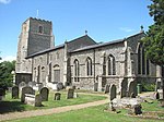
Eccles Road railway station is on the Breckland line in the east of England, serving the villages of Eccles, Quidenham and Wilby in Norfolk. The line runs between Cambridge in the west and Norwich in the east. Eccles Road is situated between Harling Road and Attleborough, 104 miles 36 chains (168.1 km) from London Liverpool Street via Ely. The station is managed by Greater Anglia, which also operates most of the services calling at the station. Some East Midlands Railway also stop at Eccles Road. The station takes its name from being outside of the now abandoned original village of Eccles although the church Eccles St. Mary still stands and is one of 124 original round-tower churches in Norfolk. A new settlement, also called Eccles, has developed around the station. The station is situated in the civil parish of Quidenham, about 2 miles (3 km) north of that village, and 1 mile (1.5 km) north-east of Snetterton Motor Racing Circuit. The station is unstaffed and has two platforms, adjacent to a level crossing. Wooden level crossing gates used to be opened and closed manually by a signaller in the local signal box, which is dated 1883. However, in 2012 the signal box was closed and the crossing was renewed with automatic barriers controlled from Cambridge. The redundant signal box stands across the road from the westbound (Cambridge) platform, and was expected to be demolished when the barriers were replaced in 2017.
Excerpt from the Wikipedia article Eccles Road railway station (License: CC BY-SA 3.0, Authors, Images).Eccles Road railway station
Station Road, Breckland District
Geographical coordinates (GPS) Address Nearby Places Show on map
Geographical coordinates (GPS)
| Latitude | Longitude |
|---|---|
| N 52.47062 ° | E 0.96961 ° |
Address
Station Road
NR16 2PE Breckland District
England, United Kingdom
Open on Google Maps


