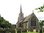
Kenninghall
Breckland DistrictCivil parishes in NorfolkVillages in Norfolk

Kenninghall is a village and civil parish in Norfolk, England, with an area of 5.73 sq mi (14.8 km2) and a population of 950 at the 2011 census. It falls within the local government district of Breckland. Home to the kings of East Anglia, after the Norman invasion of 1066 William the Conqueror granted the estate to William of Albany and his heirs as a residence for the Chief Butler of England.
Excerpt from the Wikipedia article Kenninghall (License: CC BY-SA 3.0, Authors, Images).Kenninghall
Quidenham Road, Breckland District Kenninghall
Geographical coordinates (GPS) Address Nearby Places Show on map
Geographical coordinates (GPS)
| Latitude | Longitude |
|---|---|
| N 52.4385 ° | E 0.9924 ° |
Address
Quidenham Road
Quidenham Road
NR16 2EF Breckland District, Kenninghall
England, United Kingdom
Open on Google Maps


