Tai Po Road
FanlingFo TanInfobox road instances in Hong KongInfobox road maps tracking categoryMa Liu Shui ... and 10 more
Pak Shek KokRoads in New KowloonRoads in the New TerritoriesRoute 9 (Hong Kong)Sha TinSham Shui PoSheung ShuiSo UkTai PoTai Wai
Tai Po Road is the second longest road in Hong Kong (after Castle Peak Road). It spans from Sham Shui Po in Kowloon to Tai Po in the New Territories of Hong Kong. Initially, the road was named Frontier Road.
Excerpt from the Wikipedia article Tai Po Road (License: CC BY-SA 3.0, Authors).Tai Po Road
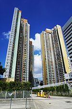
Tai Po Road – Sha Tin, Sha Tin District
Geographical coordinates (GPS) Address Nearby Places Show on map
 Continue reading on Wikipedia
 Geographical coordinates (GPS)
| Latitude | Longitude |
|---|---|
| N 22.38893 ° | E 114.19353 ° |
Address
大埔公路-沙田段 Tai Po Road – Sha Tin
Tai Po Road – Sha Tin
Sha Tin District
Hong Kong, China
Open on Google Maps