place

The Wrythe

Areas of LondonDistricts of the London Borough of SuttonUse British English from September 2015
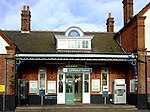
Wrythe Green Newsagents, Carshalton geograph.org.uk 486379

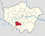
The Wrythe is a district of Carshalton, South London, located in the London Borough of Sutton. The area is located 9.3 miles South of Charing Cross and is surrounded by the adjacent areas of Hackbridge and Croydon to the east, Morden and Mitcham to the north, Sutton to the west. The area is commonly referred to as Wrythe Green which is located at the centre of the neighbourhood. It is thought that the name derives from a spring which is related to the River Wandle which runs through the east of the area from the Carshalton ponds. The Wrythe had a population of 10,163 in the 2011 Census.

Excerpt from the Wikipedia article The Wrythe (License: CC BY-SA 3.0, Authors, Images).

The Wrythe
Culvers Way, London The Wrythe (London Borough of Sutton)

Geographical coordinates (GPS) Address Nearby Places
placeShow on map

Wikipedia: The WrytheContinue reading on Wikipedia

Geographical coordinates (GPS)

Latitude Longitude
N 51.374166666667 ° E -0.16555555555556 °
placeShow on map

Address

Culvers Way

Culvers Way
SM5 2LU London, The Wrythe (London Borough of Sutton)
England, United Kingdom
mapOpen on Google Maps

Wrythe Green Newsagents, Carshalton geograph.org.uk 486379
Share experience

Nearby Places

Carshalton
Carshalton

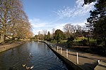
Carshalton () is a town, with a historic village centre, in south London, England, within the London Borough of Sutton. It is situated 9.5 miles (15.3 km) south-southwest of Charing Cross, in the valley of the River Wandle, one of the sources of which is Carshalton Ponds in the middle of the village. Prior to the creation of Greater London in 1965, Carshalton was in the administrative county of Surrey. Carshalton consists of a number of neighbourhoods. The main focal point, Carshalton Village, is visually scenic and picturesque. At its centre it has two adjoining ponds, which are overlooked by the Grade II listed All Saints Church on the south side and the Victorian Grove Park on the north side. The Grade II listed Honeywood Museum sits on the west side, a few yards from the water. There are a number of other listed buildings, as well as three conservation areas, including one in the village. In addition to Honeywood Museum, there are several other cultural features in Carshalton, including the Charles Cryer Theatre and an art gallery in Oaks Park. It is also home to the Sutton Ecology Centre, and every year an environmental fair is held in Carshalton Park to the south of the village. Carshalton is part of the Carshalton and Wallington parliamentary constituency formed in 1983. Tom Brake (Liberal Democrat) was its MP from 1997 to 2019. As of 2019, Elliot Colburn (Conservative) is the current MP.The combined population of the five wards comprising Carshalton was 45,525 at the 2001 census. A majority of the population of Carshalton is in the ABC1 social group. In the 2011 Census the wards had been merged into 3 with a total population of 29,917.