Durand Close
Geography of the London Borough of Sutton
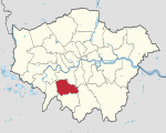
Durand Close was a housing estate situated at grid reference TQ 277 661 in Carshalton, Greater London. It held over 300 homes when it was built in the 1960s. In 2009, the estate was demolished to make way for an £83m redevelopment by Rydon Construction Ltd. The River Wandle passes through the estate from Culvers Avenue, with another opening at Buckhurst Avenue and also exits at Buckhurst Avenue.
Excerpt from the Wikipedia article Durand Close (License: CC BY-SA 3.0, Authors).Durand Close
Ferndale Crescent, London The Wrythe (London Borough of Sutton)
Geographical coordinates (GPS) Address Nearby Places Show on map
Geographical coordinates (GPS)
| Latitude | Longitude |
|---|---|
| N 51.3796 ° | E -0.1665 ° |
Address
Ferndale Crescent
Ferndale Crescent
SM5 1PE London, The Wrythe (London Borough of Sutton)
England, United Kingdom
Open on Google Maps


