place

Carshalton railway station

CarshaltonDfT Category D stationsFormer London, Brighton and South Coast Railway stationsLondon stations without latest usage statistics 1415London stations without latest usage statistics 1516
London stations without latest usage statistics 1617Rail transport stations in London fare zone 5Railway stations in Great Britain opened in 1868Railway stations in the London Borough of SuttonRailway stations served by Govia Thameslink RailwayUse British English from August 2012
Carshalton Station
Carshalton Station

Carshalton railway station is a railway station at Carshalton in the London Borough of Sutton in South London. It is located between Sutton and Hackbridge. The station is served by Southern and Thameslink. It is in Travelcard Zone 5. From here, one can catch a direct train to as far north as St Albans in Hertfordshire and southwards as far as Horsham in West Sussex. The shortest journey time from Carshalton to London Victoria is 25 minutes. The station is on the line opened by the London, Brighton and South Coast Railway between Peckham Rye and Sutton on 1 October 1868: one of the many suburban lines opened by that company. The original station of Carshalton was built on the Sutton to West Croydon line in May 1847, 1 mile (1.6 km) to the south east and is now known as Wallington station. The line runs along an embankment at this point: the ticket office is on the down side by the underbridge. Ticket barriers control access to the platforms, the only entrance to the station is via the ticket office where a book stand is located. Passengers may borrow or swap the books.

Excerpt from the Wikipedia article Carshalton railway station (License: CC BY-SA 3.0, Authors, Images).

Carshalton railway station
North Street, London The Wrythe (London Borough of Sutton)

Geographical coordinates (GPS) Address Nearby Places
placeShow on map

Wikipedia: Carshalton railway stationContinue reading on Wikipedia

Geographical coordinates (GPS)

Latitude Longitude
N 51.3686 ° E -0.1659 °
placeShow on map

Address

North Street
SM5 2HW London, The Wrythe (London Borough of Sutton)
England, United Kingdom
mapOpen on Google Maps

Carshalton Station
Carshalton Station
Share experience

Nearby Places

Carshalton
Carshalton

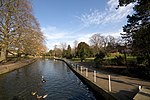
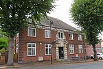
Carshalton () is a town, with a historic village centre, in south London, England, within the London Borough of Sutton. It is situated 9.5 miles (15.3 km) south-southwest of Charing Cross, in the valley of the River Wandle, one of the sources of which is Carshalton Ponds in the middle of the village. Prior to the creation of Greater London in 1965, Carshalton was in the administrative county of Surrey. Carshalton consists of a number of neighbourhoods. The main focal point, Carshalton Village, is visually scenic and picturesque. At its centre it has two adjoining ponds, which are overlooked by the Grade II listed All Saints Church on the south side and the Victorian Grove Park on the north side. The Grade II listed Honeywood Museum sits on the west side, a few yards from the water. There are a number of other listed buildings, as well as three conservation areas, including one in the village. In addition to Honeywood Museum, there are several other cultural features in Carshalton, including the Charles Cryer Theatre and an art gallery in Oaks Park. It is also home to the Sutton Ecology Centre, and every year an environmental fair is held in Carshalton Park to the south of the village. Carshalton is part of the Carshalton and Wallington parliamentary constituency formed in 1983. Tom Brake (Liberal Democrat) was its MP from 1997 to 2019. As of 2019, Elliot Colburn (Conservative) is the current MP.The combined population of the five wards comprising Carshalton was 45,525 at the 2001 census. A majority of the population of Carshalton is in the ABC1 social group. In the 2011 Census the wards had been merged into 3 with a total population of 29,917.

Carshalton Urban District

Carshalton was a local government district in north east Surrey from 1883 to 1965 around the town of Carshalton. The parish of Carshalton adopted the Local Government Act 1858 in 1883 and a local board was formed to govern the town. The Local Government Act 1894 reconstituted the area as an urban district, and an elected urban district council replaced the local board. In 1933 the boundaries of the district were altered after the abolition of Epsom Rural District.The district was abolished in 1965 by the London Government Act 1963 and the former area was transferred to Greater London to be combined with that of other districts to form the present-day London Borough of Sutton.Carshalton Urban District Council were granted armorial bearings by the College of Arms on 14 May 1952. The basic colours of the shield were gold and red, from the arms of the Mandeville family who anciently held the manor of Carshalton. The chevron in the centre of the arms was derived from the arms of the Gaynesford and Scawen families. On the chevron was placed a heraldic fountain for the many springs and pools of the town, with on either side a silver sprig of oak. The oak sprigs came from the arms of Surrey County Council. The lions appeared in the arms of three local families: Burgersh, Fellowes and Hardwick. The greyhound was from the Gaynesford family arms, and also depicted the historic Greyhound Inn. The crest above the shield featured a mural crown as symbol of local government. On this was placed a Tudor rose, the symbol of the UDC prior to 1952. From the crown rose a swan, based on the Bohun swan, the heraldic badge of the Bohun family. In the swan's beak was a sprig of beech symbolising Carshalton Beeches.The council met in the Carshalton Council Offices in The Square. The building has been Grade II listed since 1974.