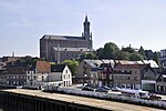
Vlierzele
East Flanders geography stubsPopulated places in East FlandersSint-Lievens-Houtem

Vlierzele is a village on the Molenbeek, in the Denderstreek, at the edge of the Flemish Ardennes, the hilly southern part of East Flanders, Belgium. It belongs to the municipality of Sint-Lievens-Houtem. Etymologically the name Vlierzele is derived from Fliteritsale (in 639) and Vliendersele (in 1412). This is a combination of either the plant name "vlier", which is Dutch for "elder", or the person's name Flether, and "sale" or "sele", which both mean place of residence in Old-Dutch.The neighbouring villages are: Bambrugge Bavegem Borsbeke Burst Erondegem Letterhoutem Ottergem Oordegem Papegem Vlekkem Zonnegem
Excerpt from the Wikipedia article Vlierzele (License: CC BY-SA 3.0, Authors, Images).Vlierzele
Hemelrijk,
Geographical coordinates (GPS) Address Nearby Places Show on map
Geographical coordinates (GPS)
| Latitude | Longitude |
|---|---|
| N 50.933333333333 ° | E 3.9 ° |
Address
Hemelrijk
Hemelrijk
9520
East Flanders, Belgium
Open on Google Maps


