Capel, Kent
Borough of Tunbridge WellsCivil parishes in KentVillages in Kent

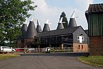
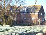
Capel is a hamlet and civil parish in the borough of Tunbridge Wells in Kent, England. The parish is located on the north of the Weald, 3 miles (4.8 km) to the east of Tonbridge. The southern part of the parish lies within the High Weald Area of Outstanding Natural Beauty, whilst most of the land also falls within the Metropolitan Green Belt. As well as Capel itself, the parish includes the communities of Castle Hill, Colts Hill, Five Oak Green, Postern, Tudeley and Whetsted.
Excerpt from the Wikipedia article Capel, Kent (License: CC BY-SA 3.0, Authors, Images).Capel, Kent
Alders Road, Tunbridge Wells
Geographical coordinates (GPS) Address Nearby Places Show on map
Geographical coordinates (GPS)
| Latitude | Longitude |
|---|---|
| N 51.1763 ° | E 0.3376 ° |
Address
Alders Road
Alders Road
TN12 6SR Tunbridge Wells
England, United Kingdom
Open on Google Maps


