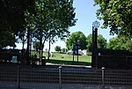
Earl's Sluice
AC with 0 elementsEngland river stubsGeography of the London Borough of SouthwarkLondon geography stubsRivers of London ... and 2 more
Subterranean rivers of LondonUse British English from January 2018

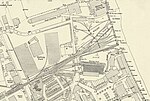
Earl's Sluice is an underground river in south-east London, England. Its source is Ruskin Park on Denmark Hill. In South Bermondsey it is joined by the River Peck before emptying into the Thames at Deptford Wharf. Earl's Creek marks the boundary between St Mary's parish, Rotherhithe and St Paul's parish, Deptford and their successors the London Borough of Southwark and the London Borough of Lewisham. It also marks the boundary between the historic counties of Kent and Surrey. The river is named after the Earl of Gloucester in the time of Henry I.
Excerpt from the Wikipedia article Earl's Sluice (License: CC BY-SA 3.0, Authors, Images).Earl's Sluice
Rope Street, London Rotherhithe (London Borough of Southwark)
Geographical coordinates (GPS) Address Nearby Places Show on map
Geographical coordinates (GPS)
| Latitude | Longitude |
|---|---|
| N 51.493108333333 ° | E -0.032016666666667 ° |
Address
South Dock Marina
Rope Street
SE16 7TY London, Rotherhithe (London Borough of Southwark)
England, United Kingdom
Open on Google Maps
