Frisby, Leicestershire

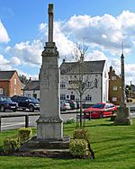
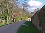
Frisby is a hamlet and civil parish in the Harborough district of Leicestershire that lies approximately 7.3 miles (11.7 km) southeast of the city of Leicester, that is now largely a deserted medieval village. According to the University of Nottingham English Place-names project, the settlement name Frisby could mean 'farm/settlement of the Frisians'. The 2011 census for Frisby returned 5 houses and 16 residents. Often termed as Frisby by Gaulby (so as not to be confused with the nearby village of Frisby on the Wreake), the modern hamlet is situated between the village of Gaulby 1 mile (1.6 km) to the southwest and Billesdon 1.94 miles (3.12 km) to the northeast. The deserted part of the ancient hamlet is a Scheduled Ancient Monument and can be located on the eastern side of the lane that leads down the hill from Gaulby Road, via Frisby House on a south-eastwards direction. The earthwork "tofts & crofts" are still visible today, with foundations for two stone built buildings noted towards the center of the site (grid reference SK 70547 01602).
Excerpt from the Wikipedia article Frisby, Leicestershire (License: CC BY-SA 3.0, Authors, Images).Frisby, Leicestershire
Gaulby Road, Harborough
Geographical coordinates (GPS) Address Nearby Places Show on map
Geographical coordinates (GPS)
| Latitude | Longitude |
|---|---|
| N 52.607499 ° | E -0.962351 ° |
Address
Gaulby Road
Gaulby Road
LE7 9BD Harborough
England, United Kingdom
Open on Google Maps


