place

Shadwell railway station

Former East London Railway stationsLondon Overground Night Overground stationsLondon stations without latest usage statistics 1415London stations without latest usage statistics 1516Rail transport stations in London fare zone 2
Railway stations in Great Britain opened in 1876Railway stations in the London Borough of Tower HamletsRailway stations served by London OvergroundRailway stations with vitreous enamel panelsUse British English from August 2012
Shadwell railway station MMB 04

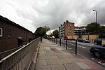
Shadwell is a London Overground station in Shadwell in East London. It was formerly a London Underground station on the East London line until 2007. The station is between Whitechapel to the north and Wapping to the south. It is located near to Shadwell DLR station. The station is in Travelcard Zone 2. The Overground station is underground (the DLR station is on a viaduct). The Overground platforms are decorated with enamel panels designed by Sarah McMenemy in 1995.

Excerpt from the Wikipedia article Shadwell railway station (License: CC BY-SA 3.0, Authors, Images).

Shadwell railway station
Cable Street, London Shadwell

Geographical coordinates (GPS) Address Nearby Places
placeShow on map

Wikipedia: Shadwell railway stationContinue reading on Wikipedia

Geographical coordinates (GPS)

Latitude Longitude
N 51.5112 ° E -0.0569 °
placeShow on map

Address

Shadwell Station

Cable Street
E1 2QF London, Shadwell
England, United Kingdom
mapOpen on Google Maps

Shadwell railway station MMB 04
Share experience

Nearby Places

Shadwell & St. George's East railway station

Shadwell was a railway station in the parish of St. George in the East, London, that was opened by the Commercial Railway (later the London and Blackwall Railway). It was situated 50 yards to the east of the current Shadwell DLR station on the Docklands Light Railway, with the former station entrance on Sutton Street (Shadwell DLR's entrance is on Watney Street). The former station was between Cannon Street Road and Stepney (now called Limehouse), and was 1 mile 5 chains (1.7 km) down-line from Fenchurch Street.Shadwell opened in October 1840, three months after the opening of the rest of the Commercial Railway, which rebranded as the LBR in 1841. It was eventually incorporated into the London, Tilbury and Southend Railway (LTSR) and was rebuilt in 1895 when the railway was widened to four tracks; Shadwell only served the slow lines on the south side. In 1900, the station was renamed Shadwell & St. George's East, possibly to distinguish it from the East London Railway (ELR) station of the same name. Apart from a wartime closure between 1916 and 1919, Shadwell & St. George's East remained open until July 1941, when dwindling passenger numbers forced its then owner, the London and North Eastern Railway, to close both it and Leman Street station. Some remains of the station can still be seen today: the westbound platform has partially survived although it is somewhat dilapidated, and the red brick station entrance on Sutton Street still survives. The Docklands Light Railway Shadwell station has been built partly on the site of the station.

St George in the East

St George-in-the-East is an Anglican Church dedicated to Saint George and one of six Hawksmoor churches in London, England. It was built from 1714 to 1729, with funding from the 1711 Act of Parliament. Its name has been used for two forms of parish (areas of land) surrounding, one ecclesiastical which remains and one a Civil counterpart, a third tier of local government. The latter assisted public facilities in the late 19th century but ceded its dwindling purposes to the Metropolitan Borough of Stepney so was abolished in 1927. The church was designated a Grade I listed building in 1950.In the 1850s, Archibald Campbell Tait, then Bishop of London, appointed a Low Church lecturer, which was contrary to the High Church attitude of the rector and curate. As a protest, there were catcalls and horn blowing, and some male members of the congregation went into the church smoking their pipes, keeping their hats on, and leading barking dogs. Refuse was thrown onto the altar. The church was closed for a while in 1859, and the rector, owing to his poor health, was persuaded by the author Tom Hughes to hand over his duties to a locum.The church was hit by a bomb during the Second World War Blitz on London's docklands in May 1941. The original interior was destroyed by the fire, but the walls and distinctive "pepper-pot" towers stayed up. In 1964 a modern church interior was constructed inside the existing walls, and a new flat built under each corner tower. Ian Nairn wrote of it in his 1966 guide to London: “A ruin among ruins, in the lost part of Stepney [after the Blitz, and before being blitzed by the Borough Council?] ... The old life has gone ... the new has not yet come ... It makes no difference to Hawksmoor’s bizarre poetry. This is probably the hardest building to describe in London ... This is a stage somewhere beyond fantasy ... it is the more-than-real world of the drug addict’s dream.”The church still has an active congregation. In May 2015, the parish entered into a partnership with the Centre for Theology and Community (CTC), an ecumenical charity which is based in its East Crypt. Anglican clergy working for CTC now serve the parish, and the second floor is the home to the Community of St George, a group of lay Christians who assist in the worship and mission of the church. St George-in-the-East is located on Cannon Street Road, between The Highway and Cable Street, in the East End of London. Behind the church lies St George's Gardens, the original graveyard, which was passed to Stepney Council to maintain as a public park in mid-Victorian times. In 1836, the parish of St George in the East was constituted as a Poor Law parish under the Poor Law Amendment Act 1834. It appeared in the 1980 film The Long Good Friday starring Bob Hoskins. It also appeared in S02E01 of Killing Eve.

East End of London
East End of London

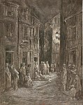
The East End of London, often referred to within the London area simply as the East End, is the historic core of wider East London, east of the Roman and medieval walls of the City of London and north of the River Thames. It does not have universally accepted boundaries to the north and east, though the River Lea is sometimes seen as the eastern boundary. Parts of it may be regarded as lying within Central London (though that term too has no precise definition). The term "East of Aldgate Pump" is sometimes used as a synonym for the area. The East End began to emerge in the Middle Ages with initially slow urban growth outside the eastern walls, which later accelerated, especially in the 19th century, to absorb pre-existing settlements. The first known written record of the East End as a distinct entity, as opposed to its component parts, comes from John Strype's 1720 Survey of London, which describes London as consisting of four parts: the City of London, Westminster, Southwark, and "That Part beyond the Tower". The relevance of Strype's reference to the Tower was more than geographical. The East End was the urbanised part of an administrative area called the Tower Division, which had owed military service to the Tower of London since time immemorial. Later, as London grew further, the fully urbanised Tower Division became a byword for wider East London, before East London grew further still, east of the River Lea and into Essex. The area was notorious for its deep poverty, overcrowding and associated social problems. This led to the East End's history of intense political activism and association with some of the country's most influential social reformers. Another major theme of East End history has been migration, both inward and outward. The area had a strong pull on the rural poor from other parts of England, and attracted waves of migration from further afield, notably Huguenot refugees, Irish weavers, Ashkenazi Jews and in the 20th century, Sylhetis. The closure of the last of the Port of London's East End docks in 1980 created further challenges and led to attempts at regeneration, with Canary Wharf and the Olympic Park among the most successful examples. While some parts of the East End are undergoing rapid change, the area continues to contain some of the worst poverty in Britain.