place

Bluegate Fields

Former slums of LondonHistory of the London Borough of Tower HamletsLondon geography stubs
Bpt6k10470488 f319
Bpt6k10470488 f319

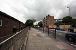
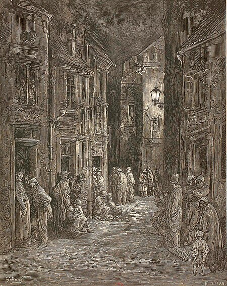
Bluegate Fields (also known as Blue Gate Fields) was one of the worst slum areas that once existed just north of the old, east London docks during the Victorian era. Two streets in the area had actually been named Bluegate Fields at different times: present-day Dellow Street (along the eastern edge of the St. George's-in-the-East churchyard) and Cable Street (along the northern edge of the churchyard). The area is visited by the eponymous character in The Picture of Dorian Gray by Oscar Wilde, and inspired a scene in The Mystery of Edwin Drood by Charles Dickens. It is referenced in the title of a song (and live album recorded at Wilton's Music Hall in Graces Alley off Cable Street) by Marc Almond.

Excerpt from the Wikipedia article Bluegate Fields (License: CC BY-SA 3.0, Authors, Images).

Bluegate Fields
Lowood Street, London Shadwell

Geographical coordinates (GPS) Address Nearby Places
placeShow on map

Wikipedia: Bluegate FieldsContinue reading on Wikipedia

Geographical coordinates (GPS)

Latitude Longitude
N 51.510277777778 ° E -0.056111111111111 °
placeShow on map

Address

Lowood House (Lowood Building)

Lowood Street
E1 0DA London, Shadwell
England, United Kingdom
mapOpen on Google Maps

Bpt6k10470488 f319
Bpt6k10470488 f319
Share experience

Nearby Places

Shadwell & St. George's East railway station

Shadwell was a railway station in the parish of St. George in the East, London, that was opened by the Commercial Railway (later the London and Blackwall Railway). It was situated 50 yards to the east of the current Shadwell DLR station on the Docklands Light Railway, with the former station entrance on Sutton Street (Shadwell DLR's entrance is on Watney Street). The former station was between Cannon Street Road and Stepney (now called Limehouse), and was 1 mile 5 chains (1.7 km) down-line from Fenchurch Street.Shadwell opened in October 1840, three months after the opening of the rest of the Commercial Railway, which rebranded as the LBR in 1841. It was eventually incorporated into the London, Tilbury and Southend Railway (LTSR) and was rebuilt in 1895 when the railway was widened to four tracks; Shadwell only served the slow lines on the south side. In 1900, the station was renamed Shadwell & St. George's East, possibly to distinguish it from the East London Railway (ELR) station of the same name. Apart from a wartime closure between 1916 and 1919, Shadwell & St. George's East remained open until July 1941, when dwindling passenger numbers forced its then owner, the London and North Eastern Railway, to close both it and Leman Street station. Some remains of the station can still be seen today: the westbound platform has partially survived although it is somewhat dilapidated, and the red brick station entrance on Sutton Street still survives. The Docklands Light Railway Shadwell station has been built partly on the site of the station.

St George in the East

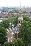
St George-in-the-East is an Anglican Church dedicated to Saint George and one of six Hawksmoor churches in London, England. It was built from 1714 to 1729, with funding from the 1711 Act of Parliament. Its name has been used for two forms of parish (areas of land) surrounding, one ecclesiastical which remains and one a Civil counterpart, a third tier of local government. The latter assisted public facilities in the late 19th century but ceded its dwindling purposes to the Metropolitan Borough of Stepney so was abolished in 1927. The church was designated a Grade I listed building in 1950.In the 1850s, Archibald Campbell Tait, then Bishop of London, appointed a Low Church lecturer, which was contrary to the High Church attitude of the rector and curate. As a protest, there were catcalls and horn blowing, and some male members of the congregation went into the church smoking their pipes, keeping their hats on, and leading barking dogs. Refuse was thrown onto the altar. The church was closed for a while in 1859, and the rector, owing to his poor health, was persuaded by the author Tom Hughes to hand over his duties to a locum.The church was hit by a bomb during the Second World War Blitz on London's docklands in May 1941. The original interior was destroyed by the fire, but the walls and distinctive "pepper-pot" towers stayed up. In 1964 a modern church interior was constructed inside the existing walls, and a new flat built under each corner tower. Ian Nairn wrote of it in his 1966 guide to London: “A ruin among ruins, in the lost part of Stepney [after the Blitz, and before being blitzed by the Borough Council?] ... The old life has gone ... the new has not yet come ... It makes no difference to Hawksmoor’s bizarre poetry. This is probably the hardest building to describe in London ... This is a stage somewhere beyond fantasy ... it is the more-than-real world of the drug addict’s dream.”The church still has an active congregation. In May 2015, the parish entered into a partnership with the Centre for Theology and Community (CTC), an ecumenical charity which is based in its East Crypt. Anglican clergy working for CTC now serve the parish, and the second floor is the home to the Community of St George, a group of lay Christians who assist in the worship and mission of the church. St George-in-the-East is located on Cannon Street Road, between The Highway and Cable Street, in the East End of London. Behind the church lies St George's Gardens, the original graveyard, which was passed to Stepney Council to maintain as a public park in mid-Victorian times. In 1836, the parish of St George in the East was constituted as a Poor Law parish under the Poor Law Amendment Act 1834. It appeared in the 1980 film The Long Good Friday starring Bob Hoskins. It also appeared in S02E01 of Killing Eve.
Shadwell Basin
Shadwell Basin

Shadwell Basin is a housing and leisure complex built around a disused dock in Wapping, London. The old dock was formerly part of the London Docks, a group of docks built by the London Dock Company at Shadwell and Wapping as part of the wider docks of the Port of London. Today Shadwell Basin is one of the most significant bodies of water surviving from the historical London Docks. It is situated on the north side of the river Thames east (downstream) of the Tower of London and Tower Bridge and west (upstream) of Limehouse. Unlike some of the London Docks which have been landfilled, Shadwell Basin, the most easterly part of the complex, has been retained. It is now a maritime square of 2.8 hectares used for recreational purposes (including sailing, canoeing and fishing) and is surrounded on three sides by a waterside housing development designed by British architects MacCormac, Jamieson, Prichard and Wright. The residential buildings are four and five storeys with façades of alternating open arches and enclosed structure, echoing the scale of traditional 19th century dockside warehouses, with a colonnade at quayside. The development, made up of Newlands Quay, Maynards Quay and Peartree Lane, was added to the National Heritage List for England by Historic England as Grade II listed in 2018, part of a first-ever listing of Post-Modern buildings.Shadwell Basin has Benson Quay on its south-west corner with its south side overlooked by Riverside Mansions in Milk Yard and the Monza Building in Monza Street and, at its south-eastern end, the former Wapping Hydraulic Power Station building. On the north side of Shadwell Basin, east of Newlands Quay, St. Paul's Church, Shadwell provides a dramatic backdrop with its spire and the St Paul's Church Conservation Area extends to the water's edge with a terraced quayside that includes an outdoor gym. A Scherzer Bascule bridge spans one of the entrances on the East side of the basin. This was built in the 1930s by the Port of London Authority and was restored by the London Docklands Development Corporation during their redevelopment of the site in the 1980s. Shadwell Basin is a popular public route for cyclists, joggers and pedestrians with a walkway alongside the water as part of the linked open spaces and canals between the river and Hermitage Basin near St Katharine Docks to the west.