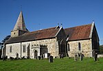
Framfield
Civil parishes in East SussexFramfieldVillages in East SussexWealden District

Framfield is a village and civil parish in the Wealden District of East Sussex, England. The village is located two miles (3 km) east of Uckfield; the settlements of Blackboys and Palehouse form part of the parish area of 6,700 acres (2,706 ha).
Excerpt from the Wikipedia article Framfield (License: CC BY-SA 3.0, Authors, Images).Framfield
Church Approach, Wealden Framfield
Geographical coordinates (GPS) Address Nearby Places Show on map
Geographical coordinates (GPS)
| Latitude | Longitude |
|---|---|
| N 50.96 ° | E 0.13 ° |
Address
Church Approach
TN22 5NJ Wealden, Framfield
England, United Kingdom
Open on Google Maps


