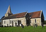
Vanguard Way
The Vanguard Way is a long-distance walk of 66.2 mi (106.5 km) from East Croydon station in outer London (OS grid reference TQ328658), travelling from the north, to Newhaven, on the south coast of England. It passes through the counties of Surrey, Kent and East Sussex, between Croydon and Newhaven, East Sussex. It connects the London suburbs to the south coast, via the North Downs, Ashdown Forest, South Downs National Park and the Cuckmere valley.The walk was developed in celebration of the 15th anniversary in 1980 of the Vanguards Rambling Club, who named themselves after an occasion when they returned from a walk travelling in the guard's van of a crowded train. The route's formal establishment occurred on 3 May 1981, and the Vanguards Rambling Club remained as the route's management until 2022, when responsibility was transferred to the Vanguard Way Association.The Vanguard Way connects with central London with the Wandle Trail along the River Wandle from Croydon and is sometimes used as a walking route between London and Paris, connecting with the ferry ports on the south coast. The walk also connects with the London Outer Orbital Path, North Downs Way, Pilgrims' Way, Greensand Way, London Countryway, Eden Valley Walk, Forest Way, Wealdway, Sussex Border Path, the South Downs Way and the England Coast Path.
Excerpt from the Wikipedia article Vanguard Way (License: CC BY-SA 3.0, Authors).Vanguard Way
Etchingwood Lane, Wealden Buxted
Geographical coordinates (GPS) Address Nearby Places Show on map
Geographical coordinates (GPS)
| Latitude | Longitude |
|---|---|
| N 50.983302 ° | E 0.148689 ° |
Address
Etchingwood Lane
TN22 5SA Wealden, Buxted
England, United Kingdom
Open on Google Maps


