place

Wyndham House, Oxford

1973 establishments in EnglandApartment buildings in EnglandBuildings and structures in OxfordHouses in OxfordshireHousing for the elderly in the United Kingdom
Oxfordshire building and structure stubsResidential buildings completed in 1973St John's College, OxfordUse British English from January 2020
Wyndham House, Oxford

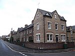
Wyndham House is a retirement home in North Oxford, England.Wyndham House was officially opened in June 1973 by Queen Elizabeth The Queen Mother. Also in attendance were Fred Ingram, the Lord Mayor of Oxford, who was involved with the scheme to establish the project. Others present included Lady Jean Rankin, a lady-in-waiting, and the Duke and Duchess of Marlborough. The facility replaced a home for elderly people in Banbury Road in North Oxford. The site was provided by St John's College, Oxford, who historically owned much of the land in the area, locally called Walton Manor. Originally, Wyndham House was a project of the British Red Cross although the connection with the Red Cross ceased in 1976. The home was previously run by the Wyndham Housing Association. It is now run by the Anchor Hanover Group.Wyndham House is located on Plantation Road and also abuts Leckford Place off Leckford Road. Opposite on Leckford Place are part of d'Overbroeck's College (for Year 7 to Year 11) and a public house on the corner with Plantation Road, The Gardener's Arms.

Excerpt from the Wikipedia article Wyndham House, Oxford (License: CC BY-SA 3.0, Authors, Images).

Wyndham House, Oxford
Plantation Road, Oxford North Oxford

Geographical coordinates (GPS) Address Website External links Nearby Places
placeShow on map

Wikipedia: Wyndham House, OxfordContinue reading on Wikipedia

Geographical coordinates (GPS)

Latitude Longitude
N 51.762658 ° E -1.266966 °
placeShow on map

Address

Wyndham House

Plantation Road
OX2 6JD Oxford, North Oxford
England, United Kingdom
mapOpen on Google Maps

Website
wyndhamhousing.org

linkVisit website

linkWikiData (Q8040119)
linkOpenStreetMap (702441274)

Wyndham House, Oxford
Share experience

Nearby Places

Observatory Street
Observatory Street

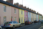
Observatory Street is a street in Oxford, England. It links at the eastern end Woodstock Road (opposite Bevington Road and St Anne's College and nearly opposite St Antony's College) in central North Oxford and at the western end Walton Street and the Jericho area of Oxford, England. The street borders the north side of Green Templeton College, one of the Oxford University colleges, which has some student accommodation in the street. The street is named after the Radcliffe Observatory (completed in 1794), which now forms a centrepiece for the College. To the north is St Bernard's Road. Observatory Street, developed from 1834, mainly consists of terraced houses directly on the street, many characterized by brightly painted stuccoed fronts in a variety of colours, especially on the south side of the street, which is very late Georgian. Once built as small dwellings for poorer inhabitants of Oxford, often workers on early railway and canal construction, the houses now command high prices because of the central location of the street, within easy walking distance of the city centre and close to the Oxford University Humanities and Mathematics site on the Radcliffe Observatory Quarter.Belsyre Court is located on the north side at the east end of Observatory Street, Woodstock Road, and the south side at the east end of St Bernard's Road. It was designed by Ernest R. Barrow and built in 1936. Belsyre Court was the first large block of flats in Oxford. An Inland Revenue office was located here from 1936 until the early 1990s. Adelaide Street branches off Observatory Street partway along and runs parallel to the north at the western end, also connecting with Walton Street.

St Sepulchre's Cemetery

St Sepulchre's Cemetery is a former cemetery located on Walton Street, Jericho, central Oxford, England. The cemetery was opened in 1848 as a cemetery for the Oxford parishes of St Giles, St Michael, and St Mary Magdalen, and the district chapelry of St Paul's Church (which included outlying parts of St Thomas's parish before St Barnabas' Church was built). The cemetery was created because all the other existing Oxford cemeteries were overcrowded after many hundreds of years of burials; two other cemeteries, Osney Cemetery and Holywell Cemetery, were also opened at the same time, to cater to the other eight Oxford parishes. In 1855, new burials were forbidden in all Oxford churchyards, with burials only to take place in existing vaults. However, this order seems to have been ignored; by 1887 the cemetery was supposedly so full that bones were littered between graves.The last new grave was dug in 1944, as St Sepulchre's finally stopped accepting new burials in 1945. The gatehouse lodge, which is owned by the city council, was let out to tenants, and the chapel was demolished in 1970. In 2004, St Sepulchre's was added to the Register of Historic Parks and Gardens, and in 2005 the group "Friends of St Sepulchre's" was created to uphold the cemetery.The cemetery was formerly surrounded on two sides by the Eagle Ironworks, which shut down in 2005 and has since been replaced by apartments. The cemetery is listed Grade II on the Register of Historic Parks and Gardens.