place

Plantation Road

1832 establishments in EnglandEngland road stubsOxfordshire geography stubsStreets in OxfordUse British English from May 2017
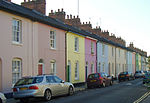
Plantation Road from Kingston Road geograph.org.uk 1760557

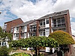
Plantation Road is a residential road in North Oxford, England, connecting Kingston Road to the west with Woodstock Road to the east.To the north is Leckford Road and to the south is St Bernard's Road. Leckford Place crosses it halfway along. The eastern part of the road is very narrow, almost like a village lane despite now being in a city suburb. In the past there was a plantation here, hence the name. The road was laid out with building plots by 1832. The philanthropic Oxford Cottage Improvement Company built a block of seven cottages in 1888 on the south side of the road. The Gardener's Arms public house, at 39 Plantation Road on the corner with Leckford Place, dates from the late 1830s and has a vegetarian restaurant. The 20th-century Wyndham House, officially opened by Queen Elizabeth the Queen Mother in 1973, provides sheltered housing with 33 flats, also on a corner with Leckford Place. The Jericho Chiropractic Clinic is at 16 Plantation Road.Towards the end of his life, the diplomat and author Sir Reader Bullard (1885–1976) lived in Plantation Road.

Excerpt from the Wikipedia article Plantation Road (License: CC BY-SA 3.0, Authors, Images).

Plantation Road
Plantation Road, Oxford North Oxford

Geographical coordinates (GPS) Address Nearby Places
placeShow on map

Wikipedia: Plantation RoadContinue reading on Wikipedia

Geographical coordinates (GPS)

Latitude Longitude
N 51.7629 ° E -1.2654 °
placeShow on map

Address

Plantation Road 69
OX2 6JE Oxford, North Oxford
England, United Kingdom
mapOpen on Google Maps

Plantation Road from Kingston Road geograph.org.uk 1760557
Share experience

Nearby Places

Observatory Street
Observatory Street

Observatory Street is a street in Oxford, England. It links at the eastern end Woodstock Road (opposite Bevington Road and St Anne's College and nearly opposite St Antony's College) in central North Oxford and at the western end Walton Street and the Jericho area of Oxford, England. The street borders the north side of Green Templeton College, one of the Oxford University colleges, which has some student accommodation in the street. The street is named after the Radcliffe Observatory (completed in 1794), which now forms a centrepiece for the College. To the north is St Bernard's Road. Observatory Street, developed from 1834, mainly consists of terraced houses directly on the street, many characterized by brightly painted stuccoed fronts in a variety of colours, especially on the south side of the street, which is very late Georgian. Once built as small dwellings for poorer inhabitants of Oxford, often workers on early railway and canal construction, the houses now command high prices because of the central location of the street, within easy walking distance of the city centre and close to the Oxford University Humanities and Mathematics site on the Radcliffe Observatory Quarter.Belsyre Court is located on the north side at the east end of Observatory Street, Woodstock Road, and the south side at the east end of St Bernard's Road. It was designed by Ernest R. Barrow and built in 1936. Belsyre Court was the first large block of flats in Oxford. An Inland Revenue office was located here from 1936 until the early 1990s. Adelaide Street branches off Observatory Street partway along and runs parallel to the north at the western end, also connecting with Walton Street.