Holy Land (Liverpool)
Merseyside geography stubsStreets in LiverpoolUse British English from March 2017
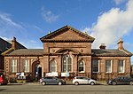
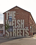
The Holy Land is an area of Dingle, Liverpool, composed of several streets with streets named after prophets, including Moses Street, Isaac Street, Jacob Street and David Street. At the end of the 19th century, it was observed that there still existed similarly named places including a farm named Jericho, a stream named Jordan and landmarks called David's Throne and Adam's Battery. Some attribute the name to the population of Nonconformists in the region in the early 17th century.Many homes on the streets are Victorian terraced houses.
Excerpt from the Wikipedia article Holy Land (Liverpool) (License: CC BY-SA 3.0, Authors).Holy Land (Liverpool)
Beresford Road, Liverpool Dingle
Geographical coordinates (GPS) Address Nearby Places Show on map
Geographical coordinates (GPS)
| Latitude | Longitude |
|---|---|
| N 53.384 ° | E -2.966 ° |
Address
Beresford Road
Beresford Road
L8 4TN Liverpool, Dingle
England, United Kingdom
Open on Google Maps


