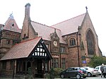
Dingle, Liverpool
Areas of LiverpoolUse British English from February 2017

Dingle (known locally as the Dingle) is an inner city area of Liverpool, Merseyside, England. It is located to the south of the city, bordered by the adjoining districts of Toxteth and Aigburth. At the 2001 Census, the population was recorded at 13,246.
Excerpt from the Wikipedia article Dingle, Liverpool (License: CC BY-SA 3.0, Authors, Images).Dingle, Liverpool
Westward View, Liverpool Dingle
Geographical coordinates (GPS) Address Nearby Places Show on map
Geographical coordinates (GPS)
| Latitude | Longitude |
|---|---|
| N 53.3774 ° | E -2.9613 ° |
Address
Westward View
Westward View
L17 7EE Liverpool, Dingle
England, United Kingdom
Open on Google Maps


