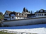
Appenzell
1403 establishments in Europe1411 establishments in Europe15th-century establishments in the Old Swiss Confederacy16th-century disestablishments in the Old Swiss ConfederacyAbbey of Saint Gall ... and 2 more
Former cantons of SwitzerlandRegions of Switzerland

Appenzell was a canton in the northeast of Switzerland, and entirely surrounded by the canton of St. Gallen, in existence from 1403 to 1597. Appenzell became independent of the Abbey of Saint Gall in 1403 and entered a league with the Old Swiss Confederacy in 1411, becoming a full member in 1513. It was divided into Appenzell Innerrhoden and Appenzell Ausserrhoden in 1597 (in a process called the Landteilung) as a result of the Swiss Reformation. The territory of Appenzell as a geographical entity is known as Appenzellerland while in political contexts, the two cantons (until 1999 half-cantons) are referred to as beide Appenzell ("both Appenzells").
Excerpt from the Wikipedia article Appenzell (License: CC BY-SA 3.0, Authors, Images).Appenzell
Rüeggerstrasse,
Geographical coordinates (GPS) Address Nearby Places Show on map
Geographical coordinates (GPS)
| Latitude | Longitude |
|---|---|
| N 47.3461 ° | E 9.3419 ° |
Address
Rüeggerstrasse
Rüeggerstrasse
9064
Appenzell Innerrhoden, Switzerland
Open on Google Maps


