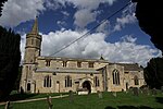
Standlake
Civil parishes in OxfordshireHarv and Sfn no-target errorsUse British English from May 2015Villages in OxfordshireWest Oxfordshire District

Standlake is a village and civil parish in West Oxfordshire about 5 miles (8 km) southeast of Witney and 7 miles (11 km) west of Oxford, England. The parish includes the hamlet of Brighthampton. The 2011 Census recorded the parish's population as 1,497. The River Windrush flows past the village and with its tributary Medley Brook it forms much of the eastern boundary of the parish. The western boundary has been subject to changes and disputes in past centuries. It now follows Brighthampton Cut, an artificial land drain dug in the 19th century. The Windrush joins the River Thames at Newbridge just over 1 mile (1.6 km) to the south.
Excerpt from the Wikipedia article Standlake (License: CC BY-SA 3.0, Authors, Images).Standlake
Horns Way, West Oxfordshire
Geographical coordinates (GPS) Address Nearby Places Show on map
Geographical coordinates (GPS)
| Latitude | Longitude |
|---|---|
| N 51.728 ° | E -1.428 ° |
Address
Horns Way
Horns Way
OX29 7SN West Oxfordshire
England, United Kingdom
Open on Google Maps


