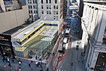
World Trade Center station (PATH)

World Trade Center is a terminal station on the PATH system, within the World Trade Center complex in the Financial District of Manhattan, New York City. It is served by the Newark–World Trade Center line at all times, as well as by the Hoboken–World Trade Center line on weekdays, and is the eastern terminus of both. The World Trade Center station is near the site of the Hudson and Manhattan Railroad's (H&M) Hudson Terminal, which opened in 1909. The Port Authority of New York and New Jersey bought the bankrupt H&M system in 1961, rebranded it as PATH, and redeveloped Hudson Terminal as part of the World Trade Center. The World Trade Center station opened on July 6, 1971, as a replacement for Hudson Terminal, which was closed and demolished as part of the construction of the World Trade Center. Following the September 11, 2001 attacks, a temporary PATH station opened in 2003 while the World Trade Center complex was being rebuilt. Work on a permanent station building commenced in 2008. The main station house, the Oculus, opened on March 3, 2016, and the terminal was renamed the World Trade Center Transportation Hub, or "World Trade Center" for short. The station has five tracks and four platforms in the middle of a turning loop. Trains from New Jersey use the loop to turn around and head back to New Jersey. The platforms are four floors below ground level. The floor immediately above the platforms is occupied by the station's fare mezzanine. The New York City Subway's WTC Cortlandt station is adjacent to and above the mezzanine. The $4 billion Oculus station house, designed by Spanish architect Santiago Calatrava, consists of white ribs that interlock high above the ground. The interior of the station house contains two underground floors, which house part of the Westfield World Trade Center mall. The transportation hub connects the various modes of transportation in Lower Manhattan, from the Fulton Center in the east to the Battery Park City Ferry Terminal in the west, and includes connections to various New York City Subway stations. It is the fifth-busiest transportation hub in the New York metropolitan area. The new station has received mixed reviews: although the hub has been praised for its design, it has also been criticized for its high costs and extended delays.
Excerpt from the Wikipedia article World Trade Center station (PATH) (License: CC BY-SA 3.0, Authors, Images).World Trade Center station (PATH)
Fulton Street, New York Manhattan
Geographical coordinates (GPS) Address External links Nearby Places Show on map
Geographical coordinates (GPS)
| Latitude | Longitude |
|---|---|
| N 40.7115 ° | E -74.0114 ° |
Address
World Trade Center Transportation Hub - Oculus
Fulton Street
10048 New York, Manhattan
New York, United States
Open on Google Maps


