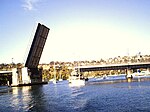
Balgowlah, New South Wales
Balgowlah, New South WalesNorthern Beaches CouncilSuburbs of SydneyUse Australian English from August 2012

Balgowlah is a suburb of northern Sydney, in the state of New South Wales, Australia. Balgowlah (or Bulgowlah) said to be an Aboriginal name for "North Harbour". The area now known as Balgowlah was known to the Aboriginals as Jilling. Balgowlah is located 12 kilometres north-east of the Sydney central business district in the local government area of Northern Beaches Council, in the Northern Beaches region. Balgowlah shares the postcode 2093 with the adjacent suburbs of Manly Vale, Balgowlah Heights and North Balgowlah.
Excerpt from the Wikipedia article Balgowlah, New South Wales (License: CC BY-SA 3.0, Authors, Images).Balgowlah, New South Wales
Seaview Street, Sydney Balgowlah
Geographical coordinates (GPS) Address Phone number Website Nearby Places Show on map
Geographical coordinates (GPS)
| Latitude | Longitude |
|---|---|
| N -33.79645 ° | E 151.25854 ° |
Address
St Cecilia’s Catholic Primary School Balhowlah
Seaview Street 59
2093 Sydney, Balgowlah
New South Wales, Australia
Open on Google Maps


