Balgowlah Heights

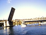
Balgowlah Heights is a suburb of northern Sydney, in the state of New South Wales, Australia 11 kilometres north-east of the Sydney central business district in the local government area of Northern Beaches Council, in the Northern Beaches region. Balgowlah Heights shares the postcode 2093 with the adjacent Balgowlah and North Balgowlah. Situated on a ridge up to 80 metres above North Harbour and Middle Harbour, some houses have panoramic views of the harbour, Eastern Suburbs and Spit Bridge. The suburb features remnant Sydney Harbour bushland, contained in the National Park around Dobroyd Head and Grotto Point. Tania Park at the eastern fringe offers relaxed recreation and one can watch the Manly ferry cut its way to Circular Quay.
Excerpt from the Wikipedia article Balgowlah Heights (License: CC BY-SA 3.0, Authors, Images).Balgowlah Heights
Lewis Street, Sydney Balgowlah Heights
Geographical coordinates (GPS) Address Website Nearby Places Show on map
Geographical coordinates (GPS)
| Latitude | Longitude |
|---|---|
| N -33.8064 ° | E 151.2568 ° |
Address
Balgowlah Heights Public School
Lewis Street
2093 Sydney, Balgowlah Heights
New South Wales, Australia
Open on Google Maps


