Ardington and Lockinge
Oxfordshire geography stubsUse British English from November 2014Vale of White Horse

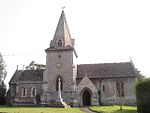
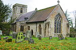
Ardington and Lockinge are two civil parishes in the Vale of White Horse district, centred about 2 miles (3 km) east of Wantage, Oxfordshire, that share a single parish council. The two parishes were part of Berkshire until 1974 when they were transferred to Oxfordshire.
Excerpt from the Wikipedia article Ardington and Lockinge (License: CC BY-SA 3.0, Authors, Images).Ardington and Lockinge
High Street, Vale of White Horse
Geographical coordinates (GPS) Address Nearby Places Show on map
Geographical coordinates (GPS)
| Latitude | Longitude |
|---|---|
| N 51.593 ° | E -1.377 ° |
Address
High Street
High Street
OX12 8PS Vale of White Horse
England, United Kingdom
Open on Google Maps


