Ardington
Civil parishes in OxfordshireOpenDomesdayOxfordshire geography stubsUse British English from August 2015Vale of White Horse ... and 1 more
Villages in Oxfordshire

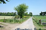
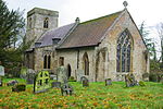
Ardington is a village and civil parish about 2 miles (3 km) east of Wantage in the Vale of White Horse. It was part of Berkshire until the 1974 boundary changes transferred it to Oxfordshire. Since 2012 responsibility for Ardington and the neighbouring parish of Lockinge has been combined in a joint single parish council for Ardington and Lockinge.
Excerpt from the Wikipedia article Ardington (License: CC BY-SA 3.0, Authors, Images).Ardington
High Street, Vale of White Horse
Geographical coordinates (GPS) Address Nearby Places Show on map
Geographical coordinates (GPS)
| Latitude | Longitude |
|---|---|
| N 51.593 ° | E -1.379 ° |
Address
High Street
High Street
OX12 8PS Vale of White Horse
England, United Kingdom
Open on Google Maps


