Pwllgwaelod
Beaches of PembrokeshireCoast of PembrokeshireHamlets in Wales

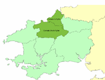
Pwllgwaelod (originally Y Pwll Gwaelod, Welsh for The Bottom Cove/Creek) is a small scattered hamlet centred on a bay on the south-western side of the Dinas Island peninsula. It is in the community of Dinas Cross between Fishguard and Newport, Pembrokeshire, Wales. Many of the properties within the hamlet of Pwllgwaelod are holiday cottages.
Excerpt from the Wikipedia article Pwllgwaelod (License: CC BY-SA 3.0, Authors, Images).Pwllgwaelod
Pembrokeshire Coast Path,
Geographical coordinates (GPS) Address Nearby Places Show on map
Geographical coordinates (GPS)
| Latitude | Longitude |
|---|---|
| N 52.0215 ° | E -4.9085 ° |
Address
Pembrokeshire Coast Path
SA42 0XL , Dinas Cross
Wales, United Kingdom
Open on Google Maps


