place

Pantoja Park

1850 establishments in CaliforniaHistory of San DiegoLandmarks in San DiegoMunicipal parks in CaliforniaParks in San Diego
Urban public parks
Pantoja Park
Pantoja Park

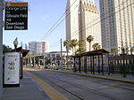
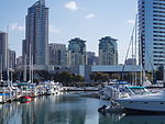
Pantoja Park is a public park located in the Marina District of Downtown San Diego, California. Originally built in 1850, it is the oldest park in the city of San Diego. The park is named for Don Juan Pantoja y Arriola, a Spanish navigator who drew the first map of San Diego Bay in 1782. In the park stands a statue of Benito Juarez, a gift from the Mexican government in 1981. Located on G Street near Columbia Street, Pantoja Park is a small oasis of open greenery in quickly redeveloping Downtown San Diego.Pantoja Park features a large grassy area and multiple large mature trees. The park has several towering old fig trees, shrubs and flowers, benches, walking paths, and a historic Natal Plum planted in the middle of the park. Two years after the formation of San Diego's Historical Resources Board, Pantoja Park was registered as the seventh San Diego Historic Landmark in 1969.

Excerpt from the Wikipedia article Pantoja Park (License: CC BY-SA 3.0, Authors, Images).

Pantoja Park
West G Street, San Diego

Geographical coordinates (GPS) Address Nearby Places
placeShow on map

Wikipedia: Pantoja ParkContinue reading on Wikipedia

Geographical coordinates (GPS)

Latitude Longitude
N 32.713011 ° E -117.167834 °
placeShow on map

Address

Benito Juarez

West G Street
92101 San Diego
California, United States
mapOpen on Google Maps

Pantoja Park
Pantoja Park
Share experience

Nearby Places

New San Diego Barracks

New San Diego Barracks also called San Diego Barracks, was an United States Army quartermaster supply depot with barracks, warehouses, stables, hay house was set up by Captain Nathaniel Lyon, with the 2nd U.S. Infantry, in 1850 at New San Diego. The depot had a wharf at San Diego Bay to load and unload supplies. The depot supported Southern California forts, stations and posts with military supplies. New San Diego Barracks was renamed to San Diego Barracks by General Orders No. 2, Military Division of the Pacific, San Francisco on April 5, 1879. The land for the depot was sold to the US Army by Gray, Johns, George F. Hooper, Davis and wife, Jose Aguirre and wife, and the heirs of Miguel de Pedrorena on September 12, 1850. The Great Flood of 1862 turned the depot into a sea of water and mud. One of the forts that San Diego Barracks supported was Fort Yuma used from 1851 to 1883. San Diego Barracks was built in what was called at the time New San Diego, on San Diego Bay, south of Pueblo de San Diego (Old Town) founded in 1835. New San Diego was built up by William Heath Davis in the early 1850s, in that he called New Town San Diego. The depot closed on December 15, 1921, when the depot moved to Fort Rosecrans.San Diego Barracks was in San Diego, California in San Diego County, is a California Historical Landmark No. 523 listed on November 1, 1954.A historical marker was put at the site of the former San Diego Barracks, on West Harbor Drive, half a block east of Ruocco Park, by San Diego County Board of Supervisors and the Historical Markers Committee in 1955.