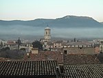
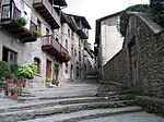
Les Planes d'Hostoles
Municipalities in GarrotxaProvince of Girona geography stubs

Les Planes d'Hostoles is a village and municipality in the province of Girona and autonomous community of Catalonia, Spain. The municipality covers an area of 37.51 square kilometres (14.48 sq mi) and the population in 2014 was 1,694. From 1900, Les Planes d'Hostoles was linked to Girona by the narrow gauge Olot–Girona railway, which was extended to Sant Feliu de Pallerols in 1902 and Olot in 1911. The line closed in 1969 and has since been converted into a greenway. In this Área there are lots of waterfalls. To visit them you need to book a ticket on the protected Space of the river Brugent.
Excerpt from the Wikipedia article Les Planes d'Hostoles (License: CC BY-SA 3.0, Authors, Images).Les Planes d'Hostoles
Carrer Major,
Geographical coordinates (GPS) Address Nearby Places Show on map
Geographical coordinates (GPS)
| Latitude | Longitude |
|---|---|
| N 42.056111111111 ° | E 2.5397222222222 ° |
Address
Carrer Major
Carrer Major
17172
Catalonia, Spain
Open on Google Maps


