L'Agullola
Catalonia geography stubsMountains of Catalonia

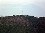
L'Agullola is a mountain of the Guilleries Massif, Catalonia, Spain. It has an elevation of 921.9 metres above sea level. The plateau known as Pla de Fàbregues lies NW of the summit. L'Agullola Grossa is a sharp rocky outcrop rising just SE of the cliff wall.
Excerpt from the Wikipedia article L'Agullola (License: CC BY-SA 3.0, Authors, Images).L'Agullola
Camí de la Donada,
Geographical coordinates (GPS) Address Nearby Places Show on map
Geographical coordinates (GPS)
| Latitude | Longitude |
|---|---|
| N 42.0045 ° | E 2.4829527777778 ° |
Address
Camí de la Donada
Camí de la Donada
08569
Catalonia, Spain
Open on Google Maps


