Nonington
Civil parishes in KentHutterite communities in EuropeVillages in Kent

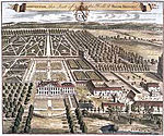
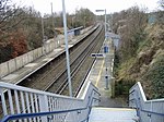
Nonington (variously, Nonnington, Nunyngton, Nonnyngton and Nunnington), is a civil parish and village in east Kent, halfway between the historic city of Canterbury and the channel port town of Dover. The civil parish includes the hamlets of Easole Street, to which it is conjoined, Holt Street and Frogham. The 2021 census gives the population of the parish as 920. The area of the parish at 31 December 2020 is 2,510 acres (1,020 ha).
Excerpt from the Wikipedia article Nonington (License: CC BY-SA 3.0, Authors, Images).Nonington
Pinners Lane,
Geographical coordinates (GPS) Address Nearby Places Show on map
Geographical coordinates (GPS)
| Latitude | Longitude |
|---|---|
| N 51.226 ° | E 1.228 ° |
Address
Pinners Lane
Pinners Lane
CT15 4LH
England, United Kingdom
Open on Google Maps


