Coudekerque-Branche–Fontinettes railway
Railway lines in Hauts-de-FranceRailway lines opened in 1876Standard gauge railways in France

The Coudekerque-Branche–Fontinettes railway runs along the English Channel and North Sea coast of France from a junction near Coudekerque-Branche station in Dunkirk to a junction near Les Fontinettes station in Calais. It is 41.159 kilometres (25.575 miles) long and AC electrified single track for much of its length, except for the first 10 kilometres (6.2 miles) from Dunkirk which is double track electrified with 25 kV 50 Hz. Line speeds are from 80 km/h (50 mph) to 120 km/h (75 mph). There is a movable bridge over the Aa at Gravelines to allow navigation of the river. The line is used by local trains between Calais and Dunkirk.
Excerpt from the Wikipedia article Coudekerque-Branche–Fontinettes railway (License: CC BY-SA 3.0, Authors, Images).Coudekerque-Branche–Fontinettes railway
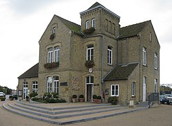
L'Européenne, Dunkirk
Geographical coordinates (GPS) Address Nearby Places Show on map
Geographical coordinates (GPS)
| Latitude | Longitude |
|---|---|
| N 50.9827 ° | E 2.2252 ° |
Address
L'Européenne
L'Européenne
59279 Dunkirk
Hauts-de-France, France
Open on Google Maps


