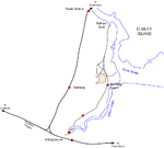
Sittingbourne and Milton Urban District
Borough of SwaleDistricts of England abolished by the Local Government Act 1972History of KentKent geography stubsSittingbourne ... and 1 more
Urban districts of England
Sittingbourne and Milton was an urban district in Kent, England, consisting of the settlements of Sittingbourne and Milton Regis. It was abolished in 1974 under the Local Government Act 1972, and made part of the Swale district.
Excerpt from the Wikipedia article Sittingbourne and Milton Urban District (License: CC BY-SA 3.0, Authors).Sittingbourne and Milton Urban District
Brewery Road, Borough of Swale Milton Regis
Geographical coordinates (GPS) Address Nearby Places Show on map
Geographical coordinates (GPS)
| Latitude | Longitude |
|---|---|
| N 51.35 ° | E 0.7326 ° |
Address
Brewery Road
Brewery Road
ME10 2EQ Borough of Swale, Milton Regis
England, United Kingdom
Open on Google Maps


