Sittingbourne

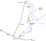
Sittingbourne is an industrial town in the Swale district, in Kent, southeast England, 17 miles (27 km) from Canterbury and 45 miles (72 km) from London, beside the Roman Watling Street, an ancient British trackway used by the Romans and the Anglo-Saxons. The town stands next to the Swale, a strip of sea separating mainland Kent from the Isle of Sheppey. The town became prominent after the death of Thomas Becket in 1170, since it provided a convenient resting point on the road from London to Canterbury and Dover. Chatham Main Line links to London Victoria station and HS1 to St Pancras International, the journey taking about an hour from Sittingbourne railway station.
Excerpt from the Wikipedia article Sittingbourne (License: CC BY-SA 3.0, Authors, Images).Sittingbourne
St. Michael's Road, Borough of Swale Regent Quay
Geographical coordinates (GPS) Address Nearby Places Show on map
Geographical coordinates (GPS)
| Latitude | Longitude |
|---|---|
| N 51.34 ° | E 0.74 ° |
Address
St. Michael's Road
ME10 3DW Borough of Swale, Regent Quay
England, United Kingdom
Open on Google Maps


