Enderby, Leicestershire

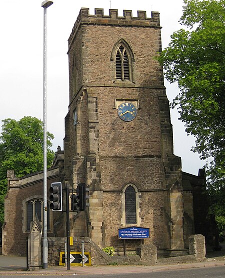
Enderby is a village and civil parish in Leicestershire, England, on the southwest outskirts of the city of Leicester. The parish includes the neighbourhood of St John's, which is east of the village separated from it by the M1 motorway. The 2011 Census recorded the parish's population as 6,314.The village's name means 'farm/settlement of Eindrithi'.The village is situated on the B4114 between Fosse Shopping Park and Narborough. The parish includes Fosse Shopping Park, Grove Park Commercial Centre and Everards Brewery. The parish is bounded by the City of Leicester and the civil parishes of Braunstone Town, Glen Parva, Lubbesthorpe, Narborough and Whetstone. The course of the Fosse Way Roman road passes through the parish. Near St John's is the deserted village of Aldeby by the River Soar.Enderby Hall was the ancestral home of the Smith family when the paternal line ended. The hall was left to Charles Loraine who took the name Charles Loraine Smith.
Excerpt from the Wikipedia article Enderby, Leicestershire (License: CC BY-SA 3.0, Authors, Images).Enderby, Leicestershire
Townsend Road,
Geographical coordinates (GPS) Address Nearby Places Show on map
Geographical coordinates (GPS)
| Latitude | Longitude |
|---|---|
| N 52.588055555556 ° | E -1.2091666666667 ° |
Address
Townsend Road
Townsend Road
LE19 4PG , Enderby
England, United Kingdom
Open on Google Maps


