Hornerstown, New Jersey
Monmouth County, New Jersey geography stubsUnincorporated communities in Monmouth County, New JerseyUnincorporated communities in New JerseyUpper Freehold Township, New JerseyUse American English from July 2023 ... and 1 more
Use mdy dates from July 2023

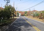
Hornerstown is an unincorporated community located within Upper Freehold Township in Monmouth County, in the U.S. state of New Jersey. Hornerstown is located near Cream Ridge and uses the 08514 ZIP code. Centered about the intersection of Hornerstown-Arneystown Road and Main Street (both separate branches of Monmouth County Route 27), the area is mostly made up of houses with horse farms west of the community. Small businesses line nearby highways CR 537 and CR 539. The town formerly had a stop on the Pemberton and Hightstown Railroad. The former railroad right-of-way has been developed into the Union Transportation Trail.
Excerpt from the Wikipedia article Hornerstown, New Jersey (License: CC BY-SA 3.0, Authors, Images).Hornerstown, New Jersey
Main Street,
Geographical coordinates (GPS) Address Nearby Places Show on map
Geographical coordinates (GPS)
| Latitude | Longitude |
|---|---|
| N 40.106111111111 ° | E -74.514166666667 ° |
Address
Main Street 20
08514
New Jersey, United States
Open on Google Maps


