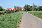
Lound, Lincolnshire
Lincolnshire geography stubsSouth Kesteven DistrictUse British English from January 2014Villages in Lincolnshire

Lound is a village in the South Kesteven district of Lincolnshire, England. It is situated about 2 miles (3 km) south-west from the town of Bourne. Originally part of the parish of Witham on the Hill, Lound became part of Toft with Lound parish between 1866 and 1931. Since 1931 Lound has been part of the civil parish of Toft with Lound and Manthorpe . At the time of Domesday Book of 1086, Lound consisted of 18 households, two mills, and a church.Earthworks of the deserted medieval village of Bowthorpe are near the 17th-century Bowthorpe Park Farm.
Excerpt from the Wikipedia article Lound, Lincolnshire (License: CC BY-SA 3.0, Authors, Images).Lound, Lincolnshire
Edenham Road, South Kesteven Toft with Lound and Manthorpe
Geographical coordinates (GPS) Address Nearby Places Show on map
Geographical coordinates (GPS)
| Latitude | Longitude |
|---|---|
| N 52.75079 ° | E -0.416581 ° |
Address
Edenham Road
Edenham Road
PE10 0LJ South Kesteven, Toft with Lound and Manthorpe
England, United Kingdom
Open on Google Maps


