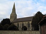
Manthorpe, Bourne
Lincolnshire geography stubsSouth Kesteven DistrictUse British English from January 2014Villages in Lincolnshire

Manthorpe is a small village in the South Kesteven district of Lincolnshire, England. It lies 0.5 miles (0.8 km) east from the A6121, 3 miles (5 km) south-west from Bourne and 6 miles (10 km) north-east from Stamford. The village is part of the Toft with Lound and Manthorpe civil parish. At the western side of the village runs the East Glen River. At Bowthorpe Park Farm is the Bowthorpe Oak, with the largest girth in the UK. The tree has a circumference of about 44 feet (13 metres).
Excerpt from the Wikipedia article Manthorpe, Bourne (License: CC BY-SA 3.0, Authors, Images).Manthorpe, Bourne
Main Street, South Kesteven Toft with Lound and Manthorpe
Geographical coordinates (GPS) Address Nearby Places Show on map
Geographical coordinates (GPS)
| Latitude | Longitude |
|---|---|
| N 52.731 ° | E -0.415 ° |
Address
Main Street
Main Street
PE10 0JE South Kesteven, Toft with Lound and Manthorpe
England, United Kingdom
Open on Google Maps


