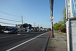
New Dorp is a neighborhood on the East Shore of Staten Island, New York City, United States. New Dorp is bounded by Mill Road on the southeast, Tysens Lane on the southwest, Amboy and Richmond Roads on the northwest, and Bancroft Avenue on the northeast. It is adjacent to Oakwood to the southwest, Todt Hill to the northwest, Dongan Hills and Grant City, and Midland Beach and Miller Field to the southeast. New Dorp Beach, bordering to the east, is often listed on maps as a separate neighborhood from Mill Road to the shore of Lower New York Bay, but is generally considered to be a part of New Dorp.
One of the earliest European settlements in the New York City area, New Dorp was founded by Dutch settlers from the New Netherland colony, and the name is an anglicization of Nieuw Dorp, meaning "New Village" in Dutch. It was historically one of the most important towns on Staten Island, becoming a part of New York City in 1898 as part of the Borough of Richmond. In the 1960s New Dorp ceased to be a distinct town during New York City's suburbanization, where rapid housing development on Staten Island saw the town added to the city conurbation. Despite this, today New Dorp remains one of the main commercial and transport centers on Staten Island.
New Dorp is often associated with the Vanderbilt family, who had a notable presence in the area and many of whom are buried in the neighborhood at the Moravian Cemetery, the largest and oldest active cemetery on Staten Island.
New Dorp is part of Staten Island Community District 2 and its ZIP Code is 10306. New Dorp is patrolled by the 122nd Precinct of the New York City Police Department.


