place

Grant City, Staten Island

Neighborhoods in Staten Island
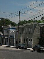
Welcome to Grant City, SI; Lincoln & North RR Aves

Grant City is the name of a neighborhood located on the East Shore of Staten Island, New York City. To the east of Grant City lies Midland Beach, and a high cliff to the west of Richmond Road separates Grant City from Todt Hill. New Dorp is situated immediately south of Grant City. Dongan Hills is situated to the north.

Excerpt from the Wikipedia article Grant City, Staten Island (License: CC BY-SA 3.0, Authors, Images).

Grant City, Staten Island
Lincoln Avenue, New York Staten Island

Geographical coordinates (GPS) Address Nearby Places
placeShow on map

Wikipedia: Grant City, Staten IslandContinue reading on Wikipedia

Geographical coordinates (GPS)

Latitude Longitude
N 40.579166666667 ° E -74.108055555556 °
placeShow on map

Address

Lincoln Avenue 145
10306 New York, Staten Island
New York, United States
mapOpen on Google Maps

Welcome to Grant City, SI; Lincoln & North RR Aves
Share experience

Nearby Places

New Dorp, Staten Island

New Dorp is a neighborhood on the East Shore of Staten Island, New York City, United States. New Dorp is bounded by Mill Road on the southeast, Tysens Lane on the southwest, Amboy and Richmond Roads on the northwest, and Bancroft Avenue on the northeast. It is adjacent to Oakwood to the southwest, Todt Hill to the northwest, Dongan Hills and Grant City, and Midland Beach and Miller Field to the southeast. New Dorp Beach, bordering to the east, is often listed on maps as a separate neighborhood from Mill Road to the shore of Lower New York Bay, but is generally considered to be a part of New Dorp. One of the earliest European settlements in the New York City area, New Dorp was founded by Dutch settlers from the New Netherland colony, and the name is an anglicization of Nieuw Dorp, meaning "New Village" in Dutch. It was historically one of the most important towns on Staten Island, becoming a part of New York City in 1898 as part of the Borough of Richmond. In the 1960s New Dorp ceased to be a distinct town during New York City's suburbanization, where rapid housing development on Staten Island saw the town added to the city conurbation. Despite this, today New Dorp remains one of the main commercial and transport centers on Staten Island. New Dorp is often associated with the Vanderbilt family, who had a notable presence in the area and many of whom are buried in the neighborhood at the Moravian Cemetery, the largest and oldest active cemetery on Staten Island. New Dorp is part of Staten Island Community District 2 and its ZIP Code is 10306. New Dorp is patrolled by the 122nd Precinct of the New York City Police Department.

Last Chance Pond Park

Last Chance Pond Park is a wetland park located on Staten Island's East Shore and part of the main channel of the New Creek stream and the Staten Island Bluebelt. Located on the northeast migration flyway, Last Chance Pond Park hosts a wide range of local flora and fauna that visit and live in the landscape of the park that includes two saltwater marshes, a fresh spring, and a freshwater pond. The park was named after the Last Chance Pond and Wilderness Foundation which helped to preserve the site starting in the mid-1960s.Before the completion of the Verrazzano-Narrows Bridge, the neighborhood of Dongan Hills contained mostly wetlands, one and two-family detached homes, and garden apartments. The park area had 50 lots that were previously undeveloped wetlands with "no trails or signs indicating the pond's presence." With the bridge opening the residents had concerns about developers "buy[ing] old homes, tear[ing] them down and build[ing] town houses, changing the neighborhood's character."The Last Chance Pond and Wilderness Foundation was established in the mid 1960 by local residents Lou Caravone and John Mouner to preserve the existing multiplicity-owned wetlands in the face of "rapid, uncheck development." However, at the time more than a third of the lots were owned by New York City and the baseball little league and the New York State Department of Environmental Conservation had temporarily designated the site as a "tidal wetland." Private developers also did not have "serious plans to build on the site" due to the upfront cost to fill and drain the wetland.With political support, the foundation was able to get the New York State Nature and Historical Preserve Trust (now the New York State Office of Parks, Recreation and Historic Preservation) to purchase land and donate it to the city. As a result, the park was officially established in 1999 with natural woodland, marshes, and a pond. In 2019, as a part of the funding from Mid-Island Bluebelt Phase II and New Creek Bluebelt project, the pond and wetland areas was rebuilt to provide a natural filter for excess runoff.